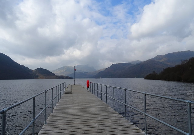
We got off the 208 bus at Aira Force so we could take a few photos of the shoreline. We were killing time waiting for the 508 to take us to Pooley Bridge where we were starting our walk proper.
Ullswater from Aira Force pier
Once at Pooley Bridge we walked up to Roehead and toward Moor Divock. We wanted to see the stone circle there and get some shots of it.
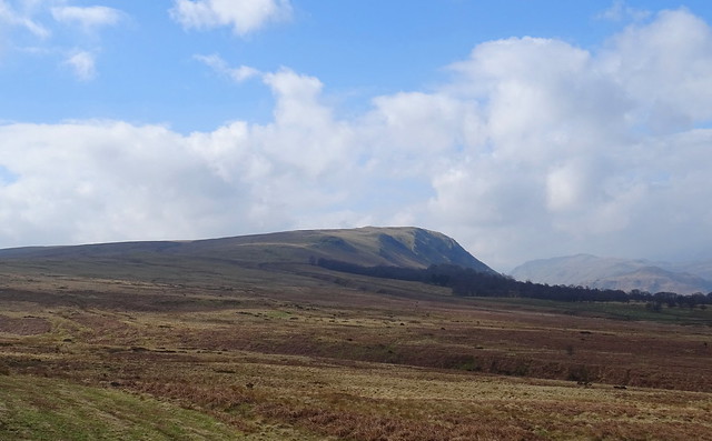
Arthurs Pike from the path
Of course when we got there two people were sitting on the stones. I did take a photo but I won't post it on here. We were walking over Loadpot Hill, Wether Hill and hoping to pitch on Steel Knotts so off we popped up the dull trudge to Loadpot Hill. Wainwright described Loadpot Hill as a walk even decrepit walkers can do so we thought this suited us down to the ground.
We stopped for some lunch near the stream from one of the reservoirs. The weather wasn't bad but it was a bit windy as we got higher. It was dry though and we even had some sunshine but the views were a little hazy.
A cairn on the way up, I think this is a boundary stone?

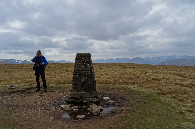
When we got to Loadpot Hill after a 6 mile walk we were dismayed to see two people sitting at the trig point. The couple who were there must have walked a similar distance to get there. I just can't understand why they couldn't offer to move out of the way so we could get some shots. We waited for 6 minutes and they seemed to be making a move so we decided to wait to see if we could get some photos of the trig point and view. They studied their map for an extra few minutes but they did leave eventually so we could get some photos and Beefy got Willo in the air. I was pleased we could get the summit to ourselves for a few minutes, it had been a long dull trudge and we needed the reward. Anyone who is doing Loadpot Hill from Pooley Bridge would be advised to go over Arthurs Pike and Bonscale Pike first.
Beefy on Loadpot Hill
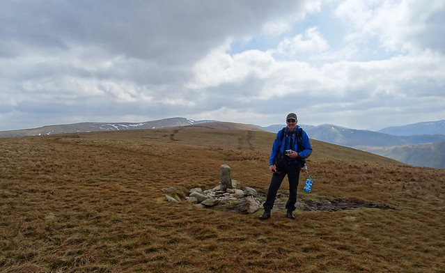
Beefy on Wether Hill
We walked further south west until we came to the second path/groove near the wall that leads down to Fusedale
Patches of snow on the descent to Fusedale
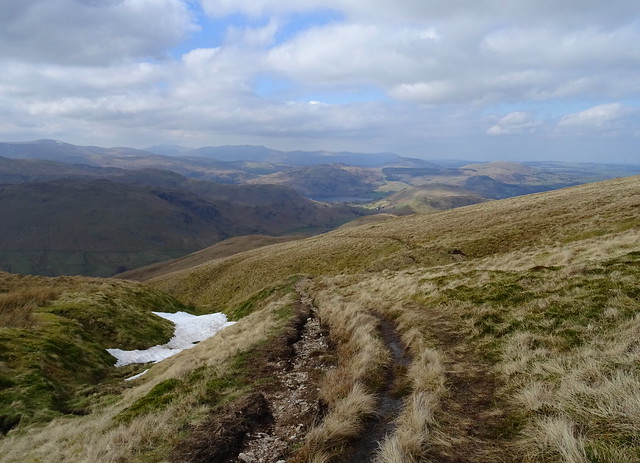
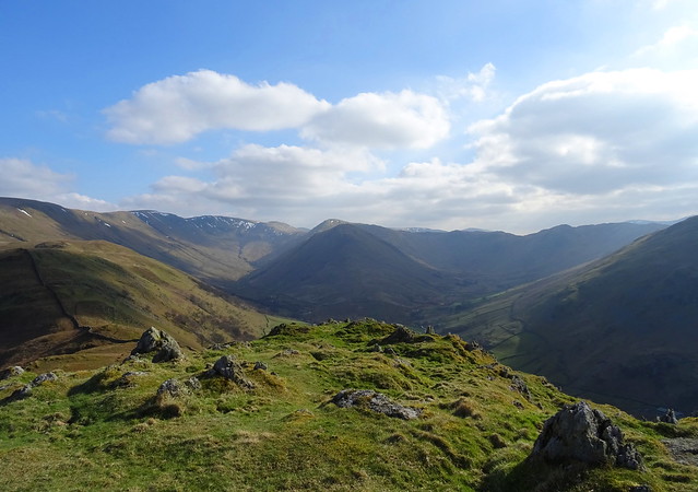
The view from the descent
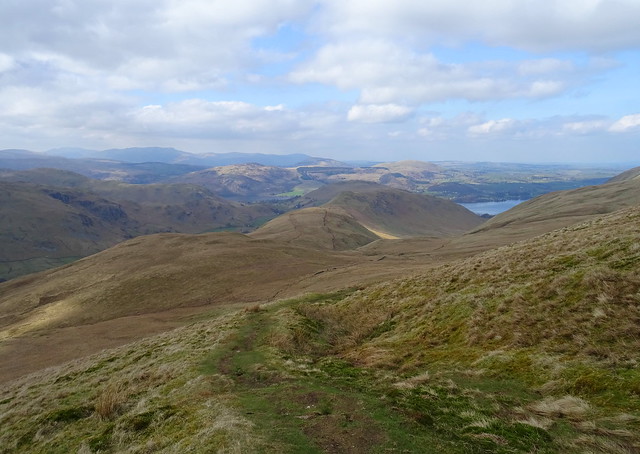
Steel Knotts in view
It seemed like it was still a long way to go. We had a break near the ruin on Fusedale Beck and got some water for our nights camp. It was lovely sitting in the sun.
Steel Knotts ahead

We were slower now, carrying 3l of water each for the last mile was hard work.
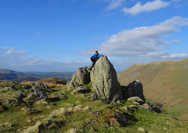
Beefy on Pikewassa the summit of Steel Knotts
Looking back at The Nab
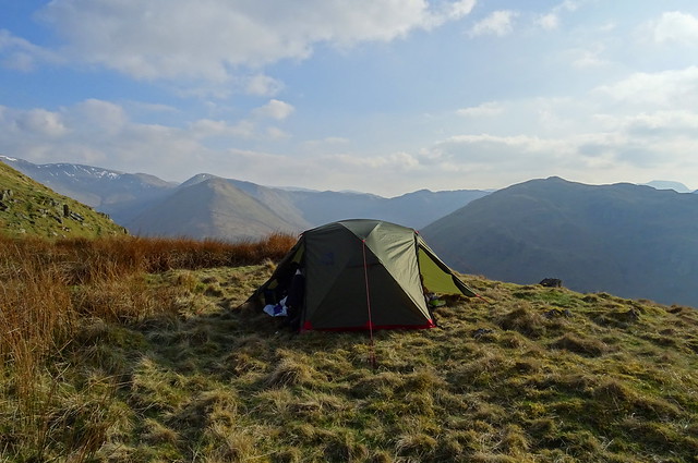
We had a look around for a place to pitch. The wind was forecast to change direction in the evening from south west to south east so we had to make sure we were sheltered from it. We found a place behind a knoll that was ok and got the tent up after setting our water up to filter.
The MSR pitched below Steel Knotts summit
We had our tea and had a rest we were tired, it was the longest walk we have done with camping gear this year.
Beefy and the MSR
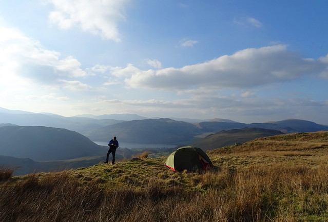
Beefy got Willo in the air for a while, then we opened the wine and waited for the sun to go down. It was hazy so we didn't know what it would be like.
The sun going down behind Great Dodd
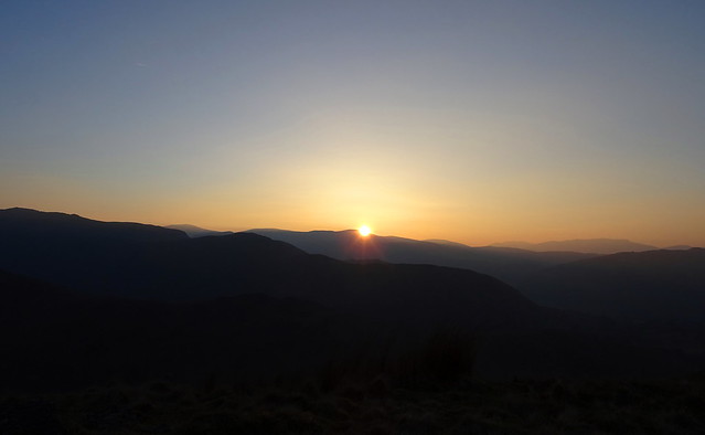
The sun disappears
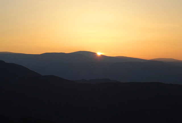
A bit of a red glow
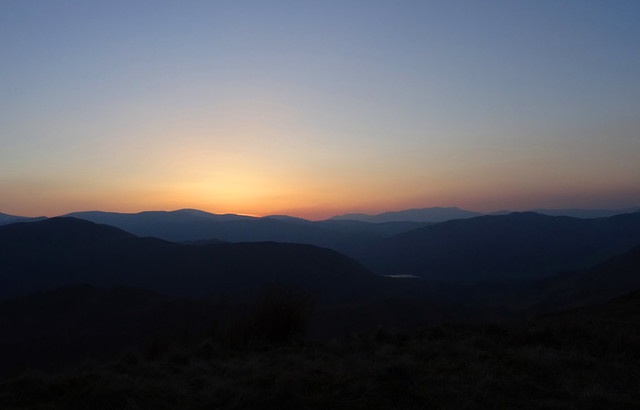
Not a bad sunset but we have had better. We'd enjoyed the day, despite the dull trudge up to Loadpot Hill. Day 1 was Pooley Bridge - Roehead - Stone Circle - Loadpot Hill - Wether Hill - Steel Knotts - pitch below the summit. 15.12km with 713m ascent. The distance includes the walk from the main road to Aira Force pier and back.
We had a peaceful night but we awoke to rain and stronger wind buffeting the tent. We weren't looking forward to getting out of the tent. We had our breakfast and packed our gear away and we were lucky. By the time we were ready to put the tent away the rain had stopped.
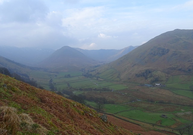
To avoid the steep routes down Birkie Knott and Steel End we went back over the summit and then doubled back on the path that descends to Martindale.
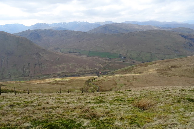
The Nab and Martindale, not so nice weather today
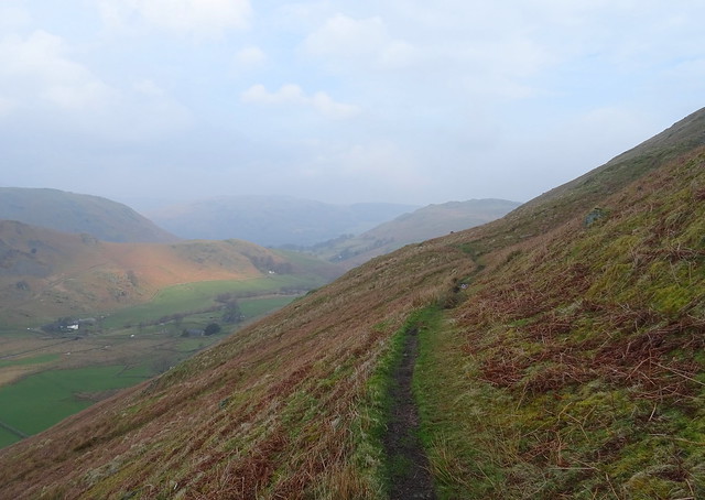
The path was very muddy and wet and it was hard work keeping on ones feet on the way down
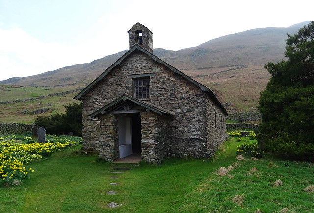
The Old Church with Winter Crag on Beda Fell behind

We took some shots of the old church before we took the lovely lane that leads to Boredale
We were going to catch our bus at Patterdale so were going over the pass at Boredale Hause.
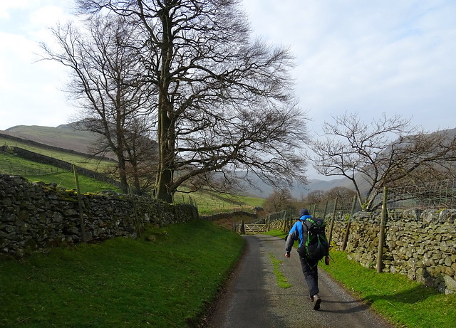
Beefy on the way to Boredale
The sun came out but the wind that was supposed to be coming from the south east was coming from the north west as we walked into the valley. Right in our faces! We said hello to two groups of DofE lads. They were very cheerful and looked like they were enjoying themselves so perhaps they weren't DofE lads!
We had a brew and some food sheltered by a wall near Boredale Head Farm.
On our way again, climbing up to the Boredale pass, what an amazing place this is

We saw some deer above us on the flanks of Place Fell but my photos weren't very good. The wind was so strong at times the camera was being shaken around.
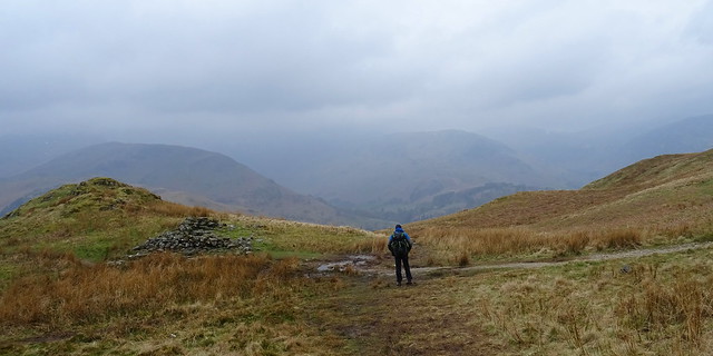
Nearly at the top of the pass

The path is very rough at this point. Thankfully the wind stopped blowing here. It was weird the wind blowing in the wrong direction and then disappearing the higher we got.
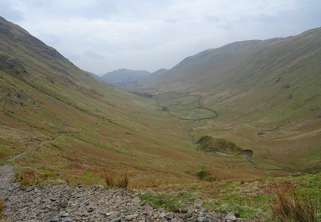
A look back at Boredale
Look at the path and the loose stones, awkward to walk on
Beefy at Chapel in the Hause
The weather looked grim on this side of the pass. We dropped down to Rooking, one of our favourite places.
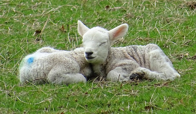
Babby lambs at Rooking

We timed the bus to perfection, just 10 minutes to wait. Our route was Steel Knotts - Martindale Old Church - Boredale Head - Chapel in the Hause - Rooking - Patterdale. 9.65km with 373m ascent. We had expected to get wet on Sunday so we were lucky to miss the rain. Not a bad weekend and it was good to push ourselves on Saturday with the longer walk and ascent. Roll on next weekend and another one.


