We spent a fortnight in California earlier this summer. The highlight for me was a couple of nights in Yosemite which allowed me to get out for a full day hike.
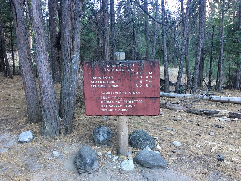
Prior to going I joined a Yosemite hiking forum to ask advice about the best hike I could do from Yosemite Valley. I got lots of helpful suggestions and decided on a circular route: starting out from our tent in Curry Village I walked along the road westwards to pick up the Four Mile Trail to Glacier Point. Glacier Point is supposed to have the best views in the park and, as you'll see later, it didn't disappoint. From Glacier Point I followed the Panorama Trail, joined the John Muir trail for a short distance and returned to the valley along the Mist Trail.
As around 4000 feet of ascent was going to come right at the start of the hike I wanted to get that out of the way before it got too hot. The first place I could get breakfast opened at 7am so I was fed and walking by 7:30am.
I may get some of the names wrong in this TR as I'm not familiar with the area, if anyone knows better please let me know.
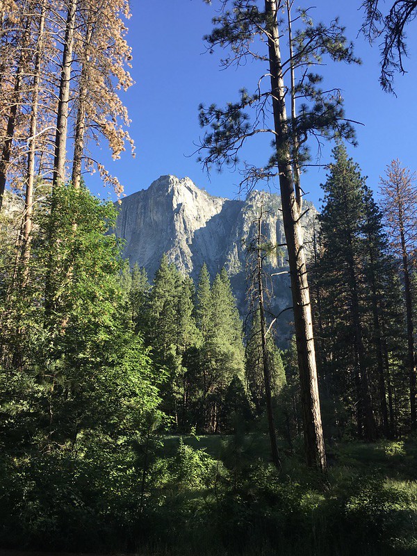
This is looking north towards Washington Column and North Dome just after I'd set off:

Shortly after I left the road I could see the scale of the climb ahead of me:

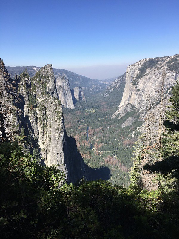
Another look north across the valley floor just before beginning the ascent:
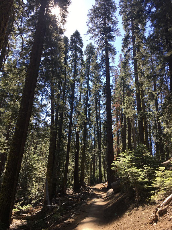
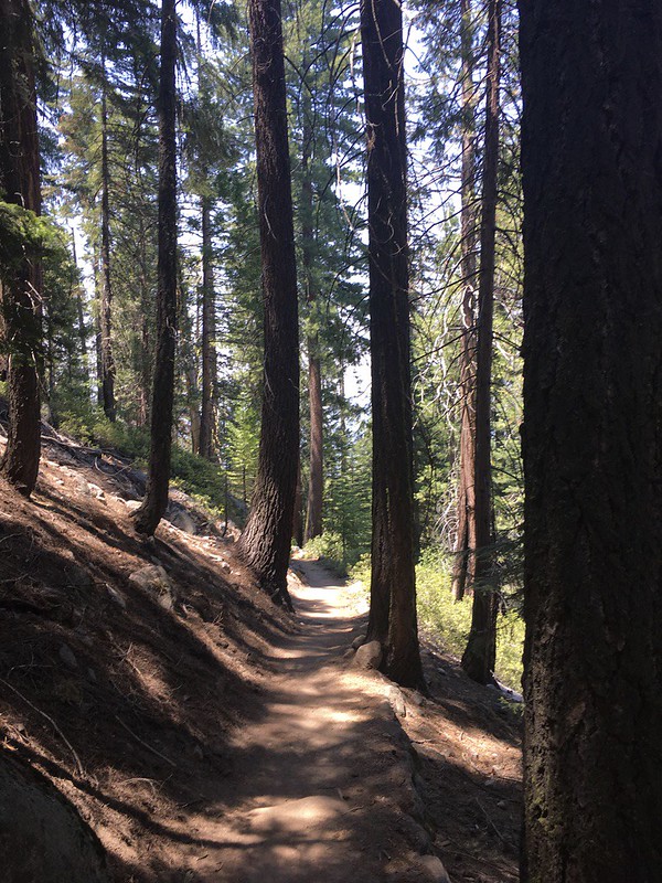
The Four Mile Trail up to Glacier Point was a seemingly endless series of switchbacks, the path was very good and in the shade so I made quick progress.
I spent the first couple of miles overtaking a German family when they stopped to rest or take photos only for them to overtake me 5 minutes later as I rested or took pictures. The views got better and better as I gained height.
This looking west down the valley with the Merced River at the bottom:
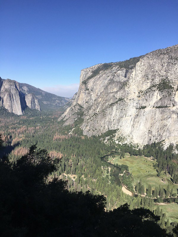
And across the valley to Yosemite Falls:

As I just said, the higher I got the better the views:
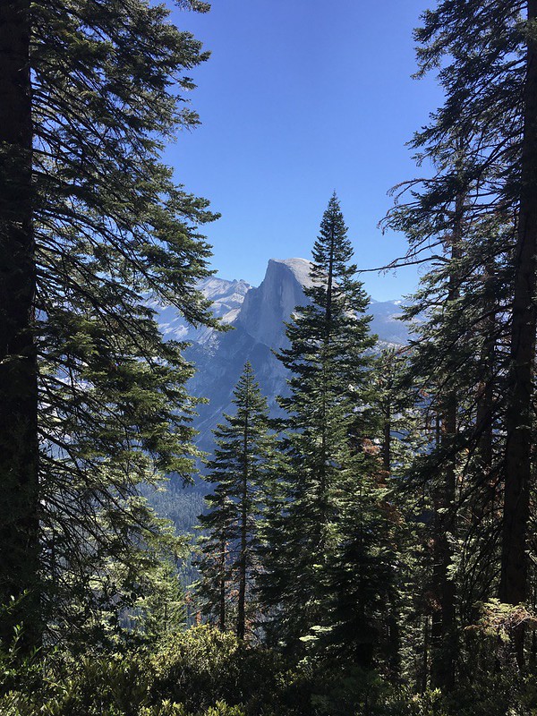
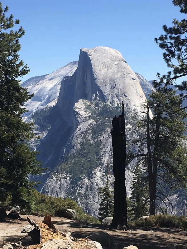
And finally a first glimpse of the legendary Half Dome through the trees:
Shortly after this the trail levelled off indicating that I was nearly at Glacier Point:
There's a shop with refreshments and a toilet at Glacier Point. There's also a road up there so I emerged from the relative solitude of the trail to find loads of people:

I bought a sandwich and a drink and had a good 30 minutes of rest here. I took a bunch of photos for some Japanese people in front of this view:

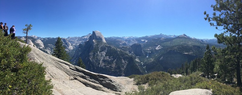
You can get to the summit of Sentinel Dome from here - it's about 2 hours there and back but as I still had at least 10 miles to do I decided against it. From Glacier Point the Panorama Trail heads south initially before turning east.
These are shortly after leaving Glacier Point, are you bored of Half Dome pictures yet?
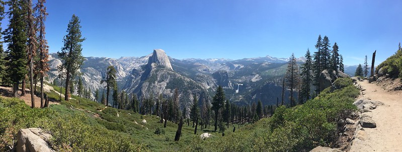
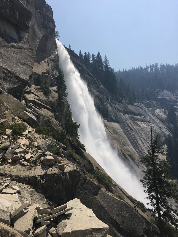
In the following photo the trail disappears off the right of the picture, drops into the valley, then climbs to the waterfalls you can see in the middle of the picture. The upper falls are Nevada Falls, the lower Vernal Falls.

The Panorama trail was much busier than the Four Mile Trail. I assume lots of people get the shuttle bus up to Glacier Point, thereby cutting out almost all of the ascent, and walk back to the valley.
Looking southeast along the trail:

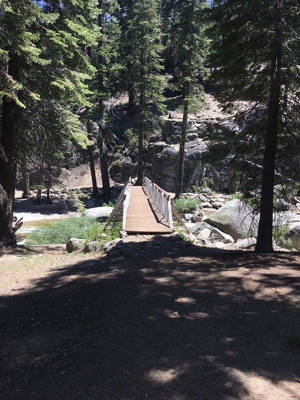
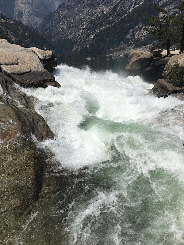
This is the small part of the John Muir trail I walked, we cross the river here and begin the ascent to the falls. It was just after midday now and getting really hot, I had my Sawyer filter with me so had a long and much need drink:

Another series of switchbacks followed as I climbed again, thankfully much of the trail was shaded by trees:
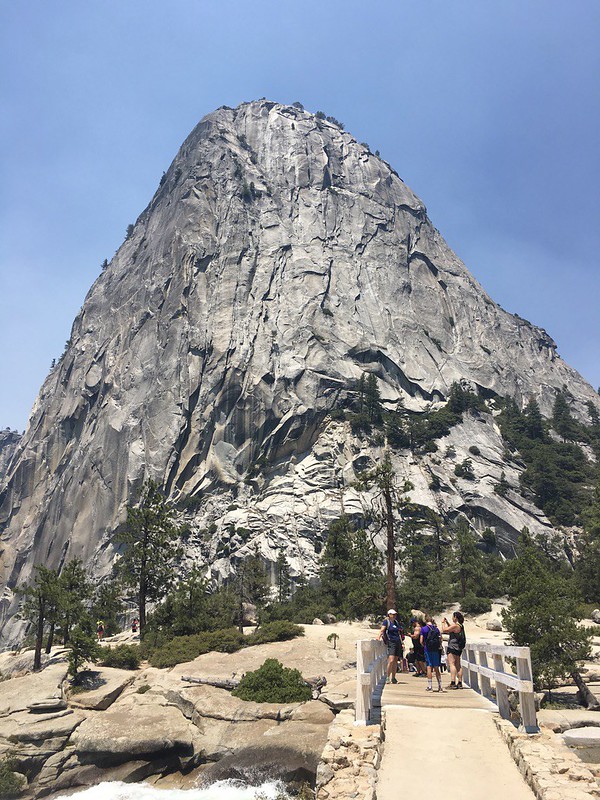
I finally emerged from the trees and reached Nevada Falls. The first photo gives you a good idea of how incredible the rock is in Yosemite. The bridge over the falls and looking down:
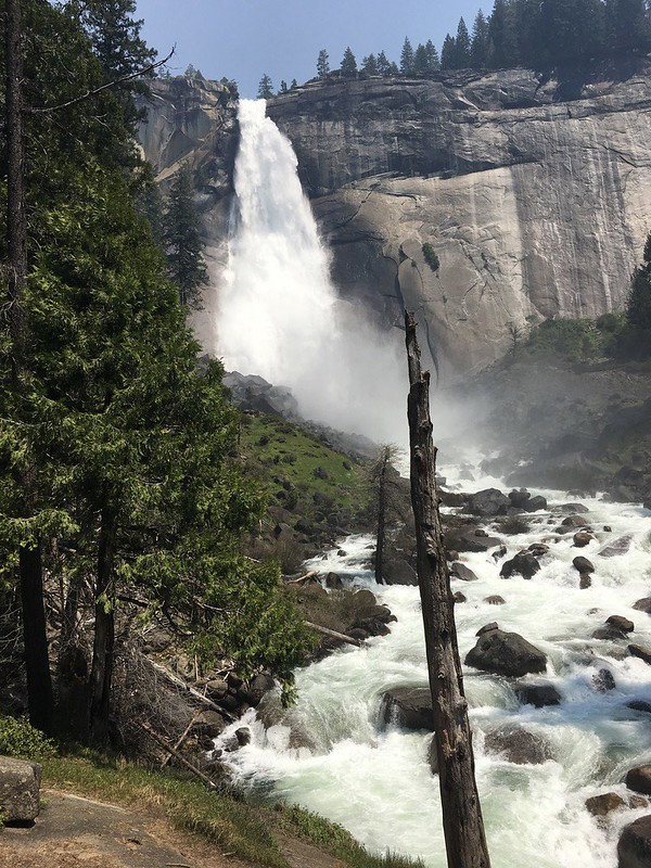
Then looking back at the falls after starting my descent back to Yosemite Valley:
It started to get really busy here, the falls are only a couple of miles from the accommodation in the valley so it's the most popular walk for most people. It was a bit congested and very slow going on these steps:

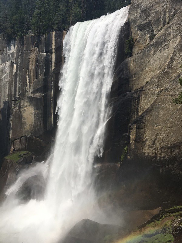
The Mist Trail is so called because of all the spray from the falls and rapids, this section would have been
better described as the 'Winter Rain in Manchester' Trail as everyone got an absolute soaking with really cold water here. It was bliss for an Englishman who had been walking for 5 or 6 hours in 25+ degrees:
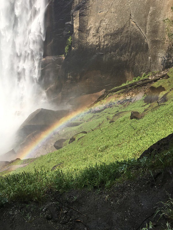
A perfect rainbow at the foot of the falls:
Soon after the falls the trail levelled out and was absolutely swarming with people, I was very much looking forward to a pint now so got a bit of a march on to finish off the last mile or so.
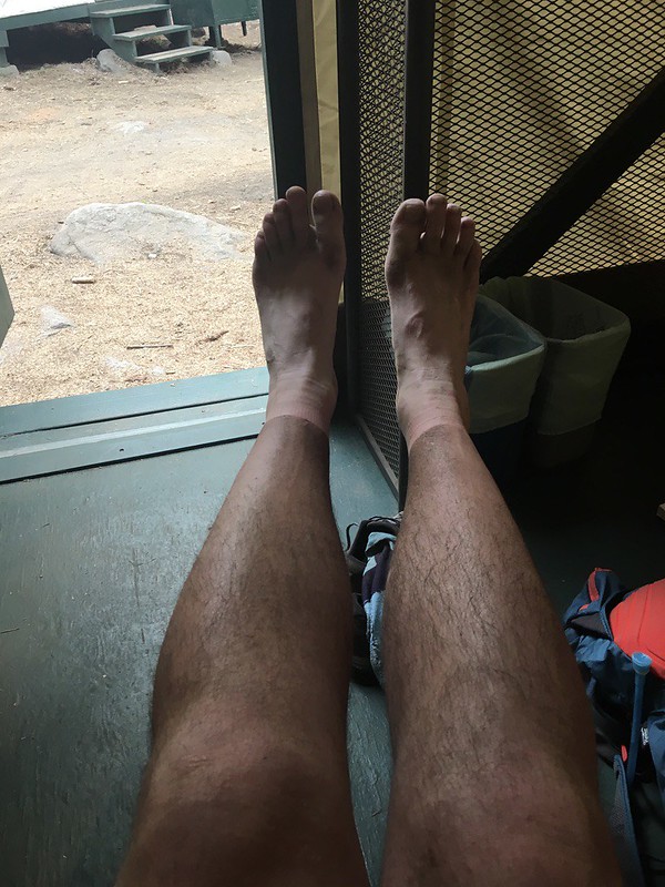
Here's what sun cream, sweat and a dusty trail do to your legs. There might be a hint of tan in there too!
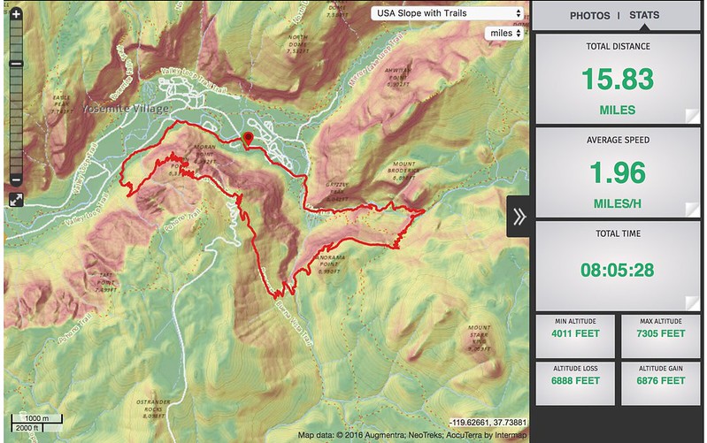
A fantastic day of walking. I'm already thinking about when I can return for an extended stay. The John Muir Trail has joined the GR20 at the top of my to do list. Here's the route and viewranger stats: