On Wednesday 15th and Thursday 16th my friend Ben and I (he of Brecon trek fame) had a little winter expedition in the 'Dark' part of the Peak District. This included a wild camp at Slippery Stones at the head of Howden Reservoir.
I picked Ben up in Matlock, and the first thing he said to me was "can we stop and get some Flu Plus? I feel like ****"
This turned out to be an 'ill omen', but I was impressed he was still up for the trek.
Day 1: Hathersage to Slippery Stones (Howden Reservoir) 14 Miles, 1000m ascent.
Our adventure began with a full english breakfast at the Pool Cafe in Hathersage (or 'Have-a-sausage' as Ben calls it). The more popular cafe above the Outside outdoor shop does not open until 9:30am, so the Pool Cafe is a good alternative for the early bird, and the proprietor is a friendly chap.
Thus fortified we set off, stopping only to buy some posh camping pans (Optimus), stove fuel and Beechams.
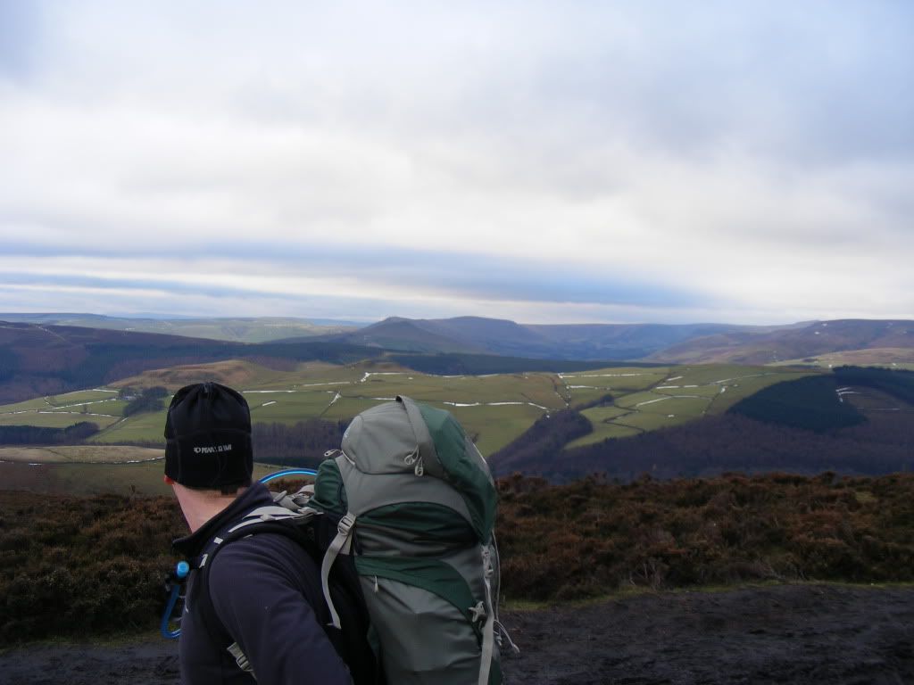
A track leaves Hathersage village centre and climbs slowly up towards Stanage Edge, Sick-Boy was going well, and we soon popped out at the foot of the impressive crag:
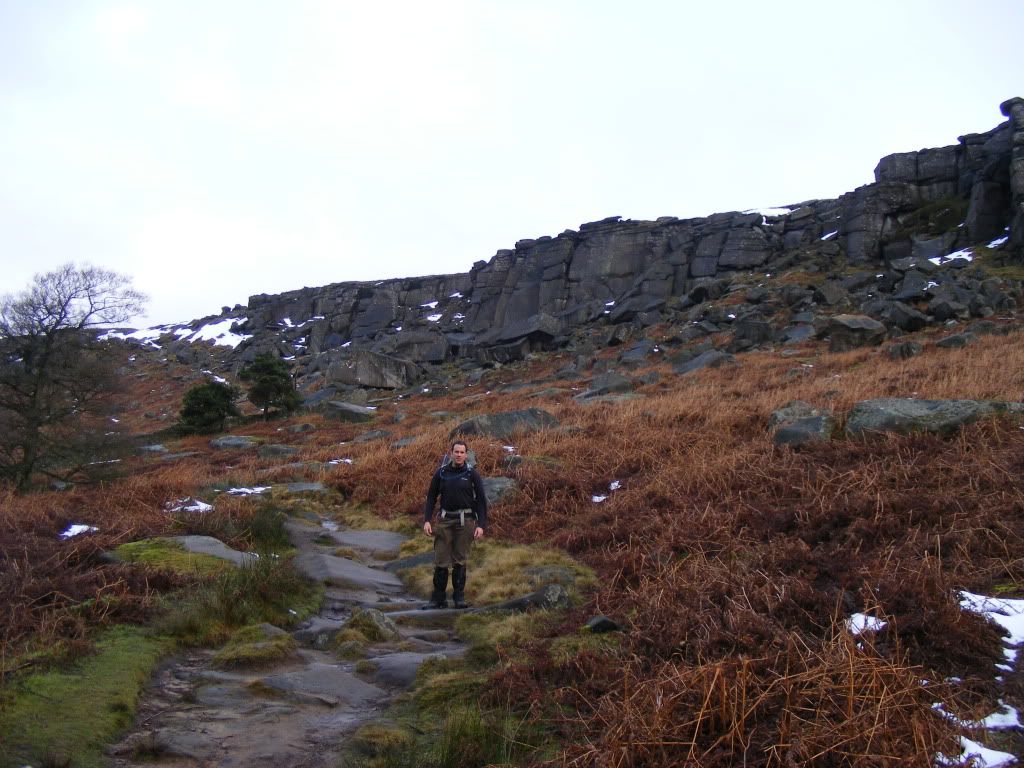
We carefully picked our way up the path onto the Edge, there was a fair bit of hard snow about so caution was required with our heavy packs on.
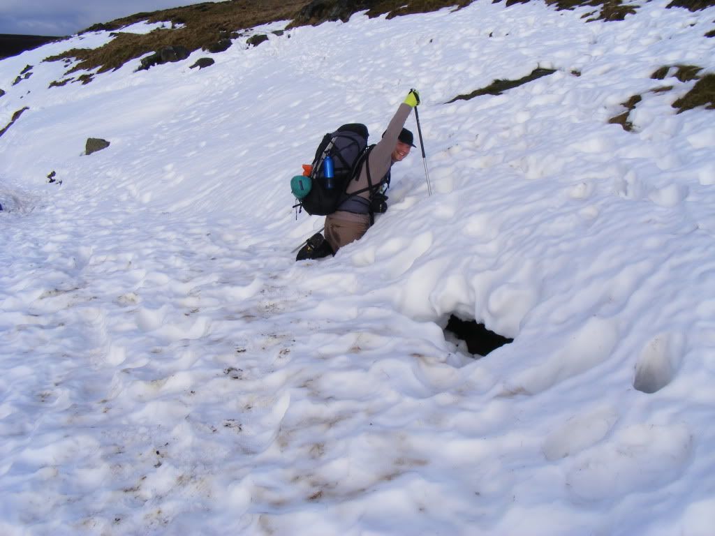
Starting off following the edge path, it is soon bisected by a track, and here the snow had accumulated in great volume. I observed the footprints of those that had gone before crossing the snowy gap 'that looks deep' I thought to myself 'I wonder if it will hold me'. It didn't, and I fell into a 'crevasse':
The day was shaping up nicely, there was a bit of sunlight here and there, streaking through the clouds. This made for some nice light as we continued to skirt the Edge, and the camera was soon out again:
Looking South:
Looking North:
The Stanage Edge path eventually descends to the road at Moscar. Our route then took us up a rather laborious climb up Derwent Moors towards the weather-ravaged gritstone formation of Wheel Stones.
Ben stopped to compeed-up a blister (new boots) "I am about to stop enjoying myself" he declared. At least in the meantime the fantastic views across to Edale and The Great Ridge kept his mind off man flu, sore feet and aching hips:
The path keeps to the high ground past White Tor, Dovestone Tor and Cakes of Bread. The grouse were in abundance and greeted us with their mocking warbles at every turn and rise of the path.
(What do grouse eat?)
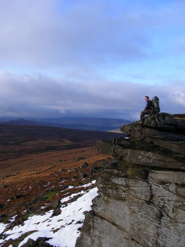
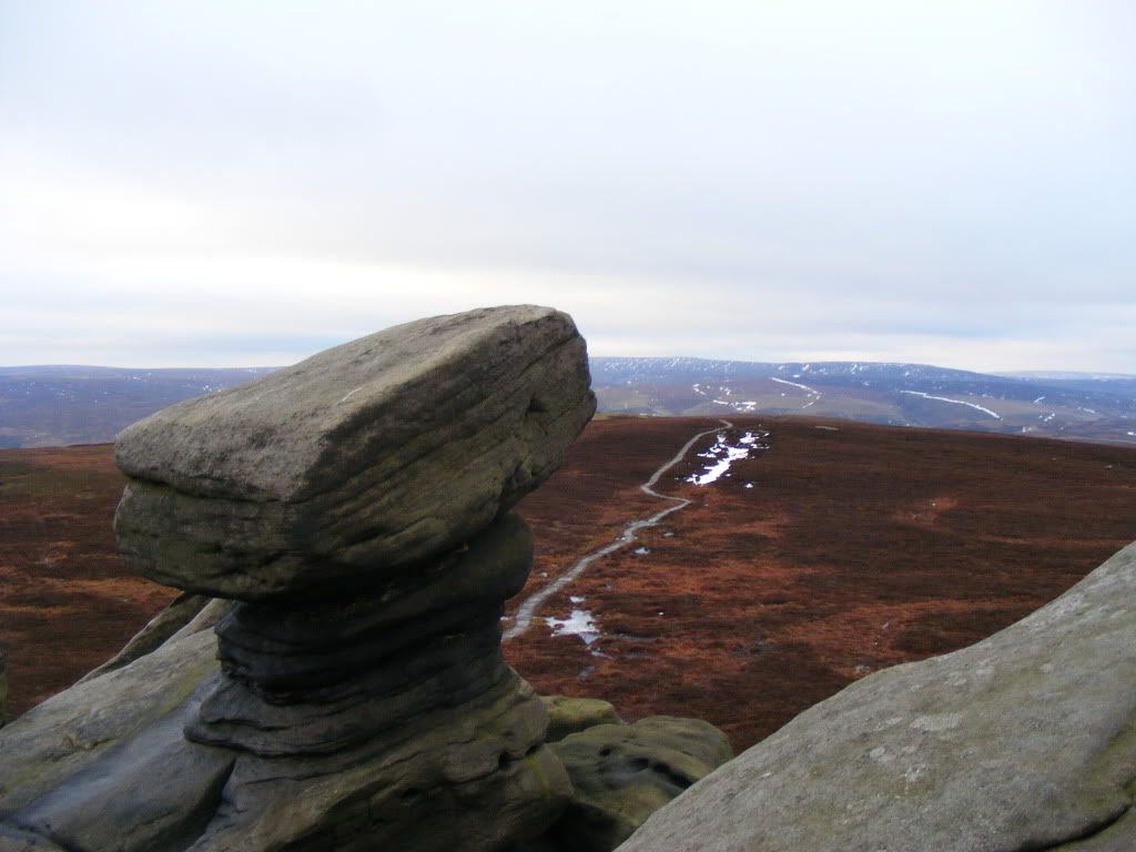
The Derwent Moors path reaches a high point at Back Tor (538m), signified by a trig point mounted atop the gritstone outcrop there.
It is a fine viewpoint indeed, and I braved the cold north wind to take some photos whilst Ben disappeared for a while to 'disturb a Mountain Hare', apparently.
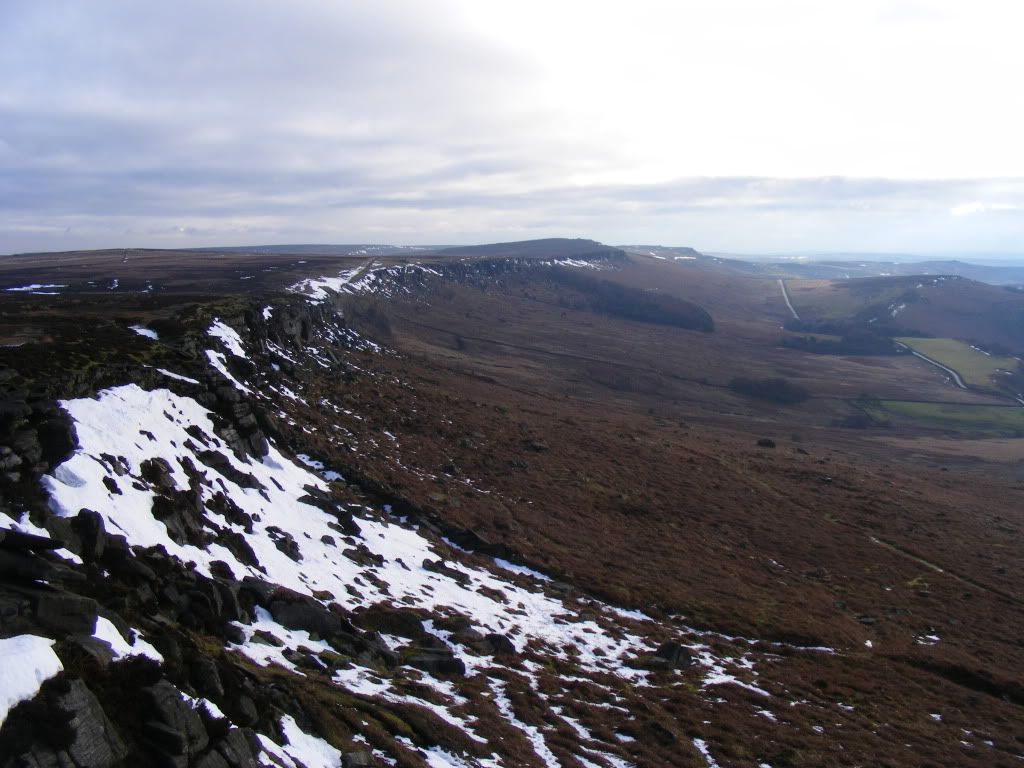
Looking back the way we'd come to Cakes of Bread and Wheel Stones:
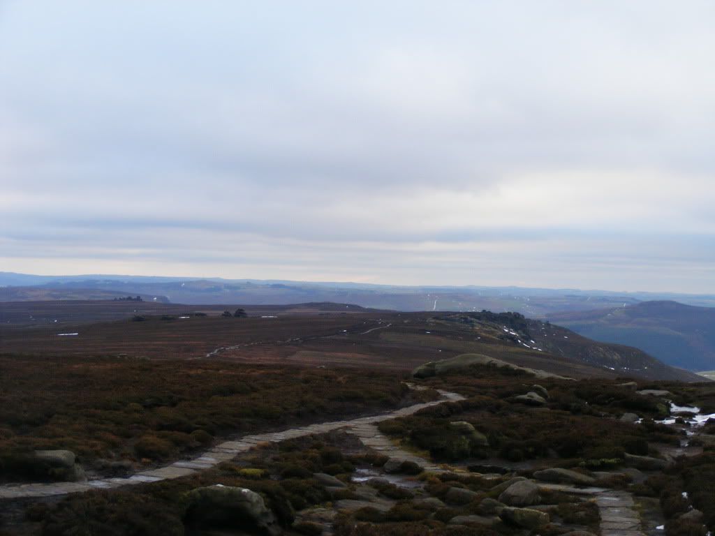
Looking ahead at the path to Lost Lad:
We shouldered our packs again and set off to Lost Lad. Shortly after we swerved away off piste, our intention was to descend Howden Dean and ascend again onto Howden Moors and the little plateau of Nether Hay before finally dropping again down the delightfully named Cranberry Clough to our campsite at Slippery Stones.
However, upon setting off across the moor, we both soon lost enthusiasm for this idea and deciding that discretion was the better part of valor, gained the path down the clough to pop-out at the top end of Derwent Reservoir near Howden Dam.
The sun had set whilst we were doing this, and we accomplished the last part of our day's walk, skirting the side of Howden Reservoir, in gathering darkness.
Howden Reservoir was displaying a white band of ice across its middle, which was a confusing sight peering down through the gloom of the pine trees. It had been cold here! Fortunately this night was not too chilly.
We made camp at Slippery Stones, which is a fine spot for a wild camp with some well-drained flat ground by the side of the fledgling River Derwent. I was not happy to see several blackened patches caused by disposable bbqs and campfires, probably from this summer. We were to leave no such traces.
Abs had snuck a christmas present into my rucksack, which turned out to be a pair of ultrawarm thermal socks - these were most welcome!
Dinner was fresh ravioli with a tomato and basil sauce, with a selection of mini cheeses mixed in.
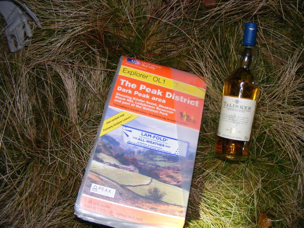
We cheered ourselves with a small bottle of Skye's finest:
...and hit the sack at about 7pm, being too tired to play cards.
It was a good job we had an early night, because the night was a disturbed one. We were warm and comfortable in our bags, but being next to Ben's coughing fits was like trying to sleep next to a barking dog, and in the night gusts of wind and rain started to batter the tent to boot.
Day 2 Slippery Stones to Ashopton 7.5 miles, 430m ascent.
We eventually rose at 8:30 with torrential rain outside. Ben was not a well man, the exertions of the day before had not done him any favours.
The morning being such a foul one, I myself was also not keen on following the plan of another 14 miles back to Hathersage via Alport Castles and Win Hill.
There would be no trekking today, we abandoned any thoughts of breakfast in favour of breaking camp as quickly as we could and getting back to civilisation asap.
We simply walked straight down the east side of Howden, Derwent and Ladybower reservoirs to gain the Snake Road at Ashopton.
The rain gave way and there was a short pause before it was replaced by heavy, wet snowfall.
It wasn't soon enough before we were installing ourselves in the Ladybower Inn to recuperate and find a local taxi number.
Hathersage Taxis took us back to our starting point for the princely sum of 8 quid.
Another enjoyable, character-building excursion!


