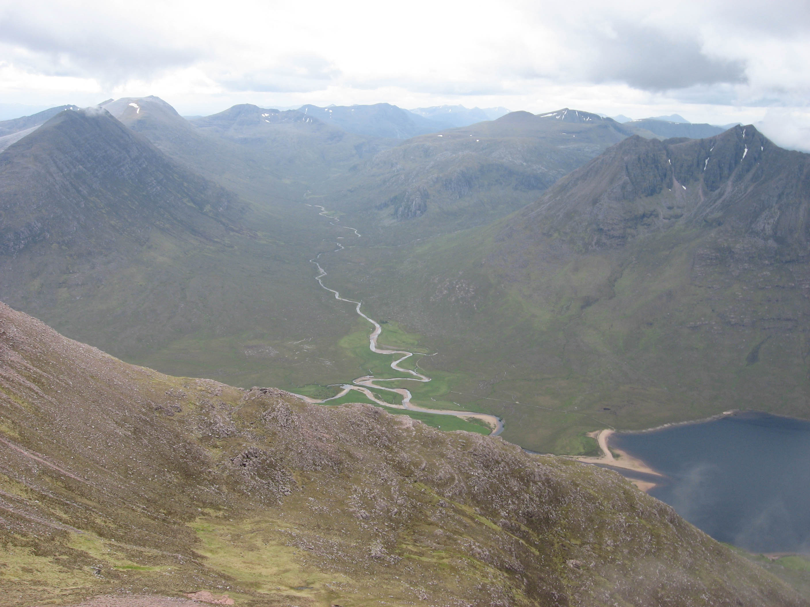
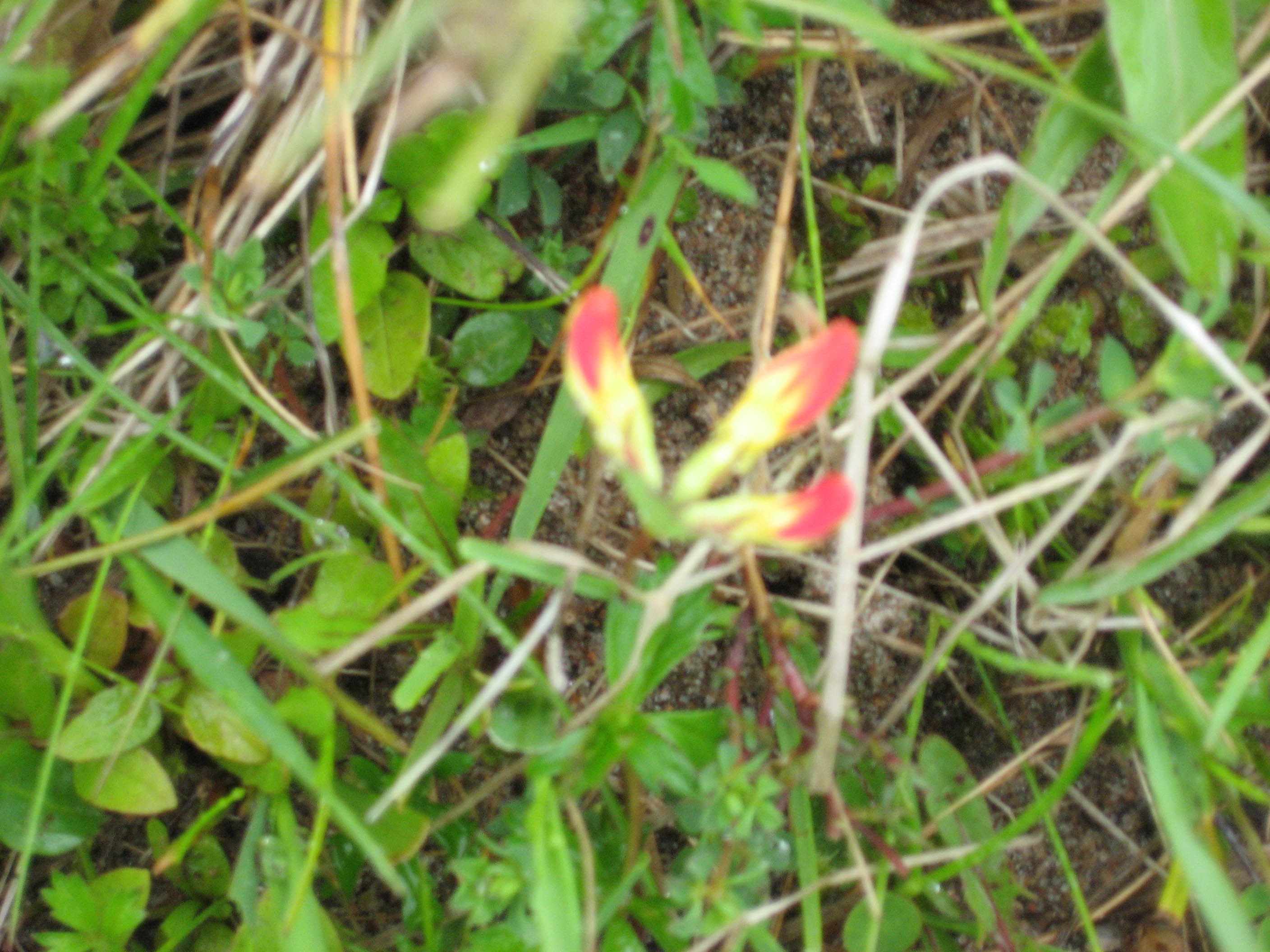
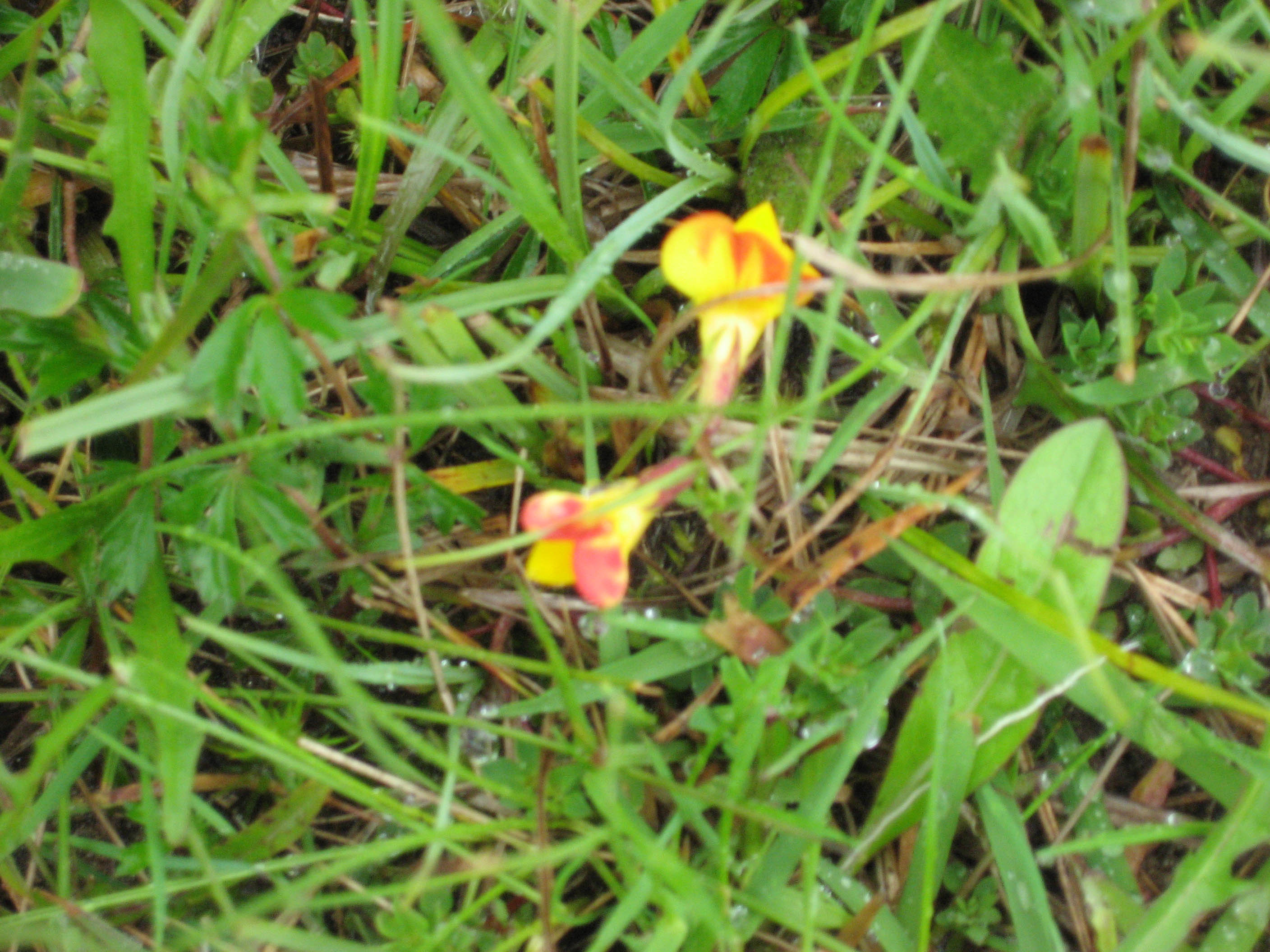
I left them in bed next morning and took the path up the hill behind Carnmore. I was quickly at the high point and then it was steeply down. I followed the Abhainn Muice downstream this flowed into the Abhainn Sheallag just before this river flows into Loch Sheallag. Shenavail my destination for the night lay just the other side of these two rivers. By now I was very wary of river crossings but I shouldn't have worried. The first I crossed by a shingle bank that went right across the river, never more than ankle deep. The bog between the two rivers was covered with a small yellow and red flower, it had three petals yellow near the steam and red at the tip. I'm not sure what it is but it was very pretty.
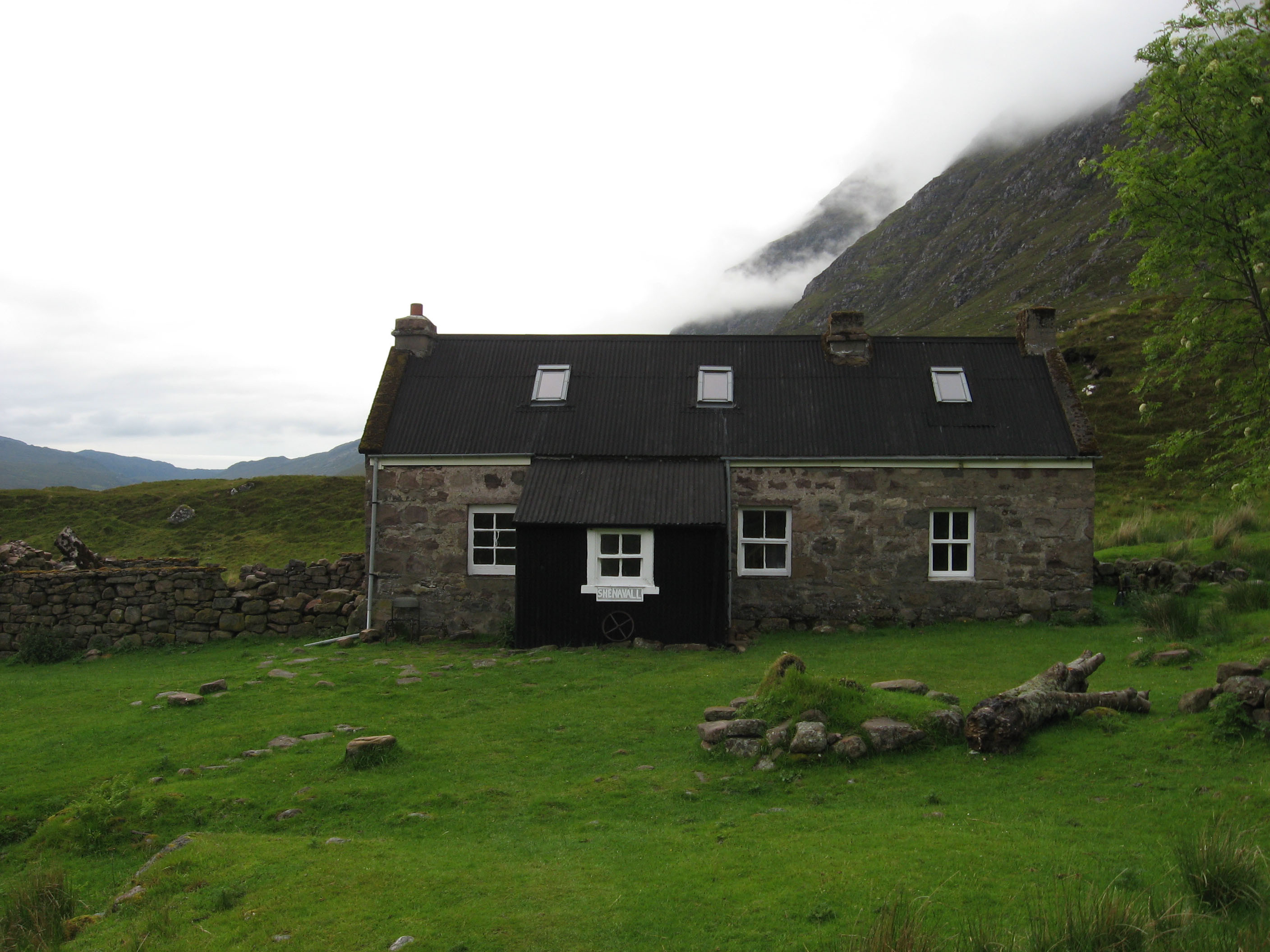
The second river was not much deeper than the first, so I got to the bothy almost dry-footed. There was no one else at the bothy just me and the mice, and there were lots of mice. I hid my porridge from them so they chewed the rubber mouth piece of my drinking tube instead, how nice!
It rained heavily again in the night and I was very undecided about An Teallach but by morning the sun was out so it was on. The path went from the bothy up back onto the sandstone, back onto the bog. It soon met the path coming up from Corriehaillie and doubles back on itself. The bog slowly gives way to scree but it was high up on Sail Liath before it finally left the bog behind. On the second peak - Stob Cadha Gobhlach - I met a lad coming the other way he warned me of going straight up the pinnacles from this side. Apparently he'd got stuck half way down a graded climb. When I got there I could see what he meant, it looked like a typical gritstone diff. The rock was wet, I was alone and had a big heavy pack on (ok the pack was much lighter than when I started but it was still heavy). There was another path that contoured around under the pinnacles, I took it. Where it re-joined the ridge I dropped the pack and scrambled back along the pinnacles, they were much easier from this side. By the time I got back to my pack the mist had closed in and by the time I reached the top of Sgurr Fiona it was raining. I pushed on to Bidein a Ghlas Thuill, here I realized I didn't know where the decent path was, there was a ridge going north and another going east, I went east. I was a long way down, all the way to Glas Mheall Liath before I decided I was off route and. turned around. Back at Bidein a Ghlas Thuill I took the north ridge and a scree filled gully lead down onto the floor of Coire a Ghlas Thuill where I pitched up for my last wild camp of this trip.
Friday my last day, I needed to be in Ullapool for the bus the following morning. I followed the stream down to the Dundonnell road. A side road lead off the other side, a big sign at the turn warned that the Altnaharrie ferry no longer ran such a pity. Instead I took a path up through a wooded glad up onto the moor above and onto Croftown on the main A835 Ullapool road. Seven miles along the side of Loch Broom but seven miles of road walking. After a mile it started to rain, jacket on. A mile further it got heavy, over trousers on. Another mile and a car stopped, he took me to Ullapool.