Author Topic: [TR] Pembrokeshire Coast Path 2015  (Read 4959 times)

kukko

  • Jr. Member
  • **
  • Posts: 80
[TR] Pembrokeshire Coast Path 2015
« on: 12:06:35, 06/11/15 »
Hey guys,
complited the Coast Path the last spring and got finally the pictures in order :)
Here's the report, hope you like it and sorry for language errors (greetings from Finland) :)

Video will follow later, much later.

After an exhausting travel, with many different trains from London Gatwick, I finally reached the village of Kilgetty, near the starting line of the trail. The day had been so far sunny and promising but when I stepped off from the train, it started to pour water. It poured like giving a last warning or a reminder if I really wanted to do this. I could still turn back. After making the last groceries, a beautiful rainbow led me towards the campsite at Stepaside, some 30 minutes away.


DAY 1, STEPASIDE to MANORBIER BAY (28th of April)
 

Distance: 33 km
Time on trail: 6:30 – 18:00
Kelpie campsite (5£ as it was officially closed)


In the morning the tent was covered with rime but I had felt warm during the night. Birds were signing loud while walking the last few kilometers to Amroth and the seaside. The Atlantic Ocean was waiting, glimmering gloriously in the morning sun.


Low tide at Saundersfoot.


While approaching the walled seaside town of Tenby and its colourful houses, westerly wind got suddenly stronger. But soon I was inside the town walls, walking along the main street. The local outdoor store had only large gas cartridges but fortunately I found a medium size from a Morris&Brothers hardware store. As always, it was a huge relief to find the gas. After a 45min lunch break I began a long stretch along the beach towards Penally and the first MoD firing range. In the freezing wind I couldn’t help but to wonder how the locals were wearing so few clothes?


A red flag in the mast meant that the army was firing in the area and I should use the inland detour.


Lydstep had a big caravan park but no one was around at the Happy Acre campsite. I decided to keep going and soon after I found nice grassy patches at the clifftops. For an hour I was trying to make up my mind whether to wild camp or push until Manorbier. My feet felt good so finally I started to move again and walked the last 6,5 km.


The Kelpey campsite was closed due to an installation of a new toilet block. I cursed my bad luck. The owner, who was a nice lady, didn’t want me at first to stay but in the end she couldn’t refuse the easy buck. I might have looked quite tired too… I stayed near the fence, out of sight, boiled pasta and observed a curious Red Robin flying around. The dark clouds promised rain for the night and I hoped by morning it would be clear again.


kukko

  • Jr. Member
  • **
  • Posts: 80
Re: [TR] Pembrokeshire Coast Path 2015
« Reply #1 on: 12:11:48, 06/11/15 »
DAY 2, MANORBIER BAY to BOSHERSTON
 

Distance: 18 km
Time on trail: 7:00 – 14:00
 Free campsite


It rained hard during the night but the morning was full of positive feeling, the air filled with the sound of waves hitting the Manorbier Bay.


Until Broad Haven I climbed up and down the seaside cliffs and passed by beautiful sandy beaches, Barafundle Bay being the most stunning. The sun was shining but the westerly wind made me feel chilly as soon as I stopped walking.


The MoD range of Castlemartin was also closed so I turned inlands and to the lily ponds of Bosherston. The ponds were quite disappointing as I didn’t see birds at all and the hard midday sun made heavily wooded slopes and the lakes look dull and uninvited. Soon after I reached the village and found an empty camping site. It felt way too early to finish the day, but as the next day I couldn’t reach any further than Angle, I decided to stay. The village didn’t offer much to see, and as no other walkers were anywhere, the rest of the evening felt long and lonely.


kukko

  • Jr. Member
  • **
  • Posts: 80
Re: [TR] Pembrokeshire Coast Path 2015
« Reply #2 on: 12:14:43, 06/11/15 »
DAY 3, BOSHERSTON to ANGLE
 

Distance: 25 km
Time on trail: 6:40 – 14:30
Castle Farm campsite 5£


Another fine morning. I walked through fields to the army barracks of Castlemartin and the observation area, from where one could see the military training. Unfortunately nothing was going on at that early so after a breakfast break, I tackled a long stretch of road walk to reach the sea again at Freshwater West.


Many ups and downs followed before I reached the Angle Peninsula and the Thorne Island, that rose from the sea like the fortress of Alcatraz. It felt strange to see the northern shore where the trail would eventually go – after walking first some 50 km around the bay of Pembroke!


Angle is a bit more lively village with a nice campsite. But still, unfortunately I was the only hiker. The next day would be all urban and industrial with oil refineries, liquid natural gas terminals and city of Pembroke waiting. My plan was to pass by it all at once. A hard 45 km walk all the way until Sandy Haven, far from the other side of the peninsula. To succeed in that, I needed some refreshments:


kukko

  • Jr. Member
  • **
  • Posts: 80
Re: [TR] Pembrokeshire Coast Path 2015
« Reply #3 on: 12:20:11, 06/11/15 »
DAY 4, ANGLE to SANDY HAVEN
 

Distance: 45 km
Time on trail: 5:45 – 18:45
Sandy Haven camping 6£


I slept restlessly, listening the low humming of the distant oil refinery. It remainded me of the coming 45 kilometers. I knew my legs could make it if just having the right attitude. You’ll set out to do something and that’s it. To help to achieve the goal, I split the day in three parts: first 4h30 minutes to the Pembroke Castle, then 4h30 minutes to Milford Haven and at last 6,5km to the final campsite.


The oil refinery loomed in the distant shore like a grotesque temple representing everything industrial. I walked closer while the morning progressed.


I reached the Pembroke Castle on time and sat down for the first lunch break. After the castle the trail headed into woodland where I got lost for some 20 minutes, and soon after got almost run over by few nervous cows. Only ninja jumps and quick feet saved me. The lost time and extra difficulties annoyed me like hell, like the day wouldn’t already be hard enough?


At the end of the bay the trail changed to road walking, and the day began to feel heavy. I passed by more and more industrial constructions, but in some way it was also interesting. Ugly but interesting. Short breaks followed one after another. It rained time to times and I had to walk the whole day in wet socks.


I don’t remember much from the last kilometres but at some point I started to believe that I was going to make it. I think I almost flew the last part but reaching the campsite was a huge disappointment. It was kind of closed and for a while I couldn’t see anyone. Finally I saw some movement in one of the holiday homes and went to ask what should I do. The man was a friend of the owner or something, and had the key to the shower block. He asked me the fee and promised to deliver it to the owner. After few hours I dropped dead, wind getting stronger and stronger outside, playing with my lonely tent.

kukko

  • Jr. Member
  • **
  • Posts: 80
Re: [TR] Pembrokeshire Coast Path 2015
« Reply #4 on: 12:23:51, 06/11/15 »
DAY 5, SANDY HAVEN to MARTIN’S HAVEN
 

Distance: 20 km
Time on trail: 7:00 – 14:00
West Hook Farm campsite 7£


Right next to the Sandy Haven campsite are series of stepping stones that can be crossed only at the right time of the day. That day the high tide was at 6:05 am and the low tide 6h10 minutes later. The stones are visible the earliest two hours before the low tide so I could safely cross the water from 10:15 am. That was definitely too much waiting for my taste as I was already up at six o’clock. The wind and rain were hammering my tent and I wanted anxiously to get moving.
I took the 1h2o minutes detour along narrow country lanes. Mist hid everything and whenever the biting wind couldn’t reach me, I sweat like a pig. Taking the detour felt stupid and exhausting but fortunately I was able to cross easily the next stepping stones at The Gann.


Near Dale the weather got seriously worse. Strong eastern wind swept over the exposed peninsula and it was pouring with water. I had to stop for a hot tea and chocolate cake. At the same time a cross country marathon and even an ultra marathon was taking place outside. Insane!


Apart from my severely leaking boots, my rain gear kept me dry enough and for a while it was nice to cheer up the muddy runners. But in that weather I decided to make the short cut through the Dale peninsula and get to the West Hook as soon as possible.


This time the campsite was open, and there were even some other campers. But unfortunately still no sign of any other hikers. And as the two girls of my age, camping next to my tent were not interested at all in my stories, fun of the whole trip was sliding further and further. The campsite was at a beautiful spot but the mist covered any views to the open sea. Darkness fell early and in my low spirits I could only hope for a drier weather again.


kukko

  • Jr. Member
  • **
  • Posts: 80
Re: [TR] Pembrokeshire Coast Path 2015
« Reply #5 on: 12:29:00, 06/11/15 »
DAY 6, MARTIN’S HAVEN to NEWGALE
 

Distance: 31,5 km
Time on trail: 7:45 – 16:15
Newgale camping 7£


At seven in the morning it had not been raining for a while and I started to walk. The visibility was close to a non-existent.


At St.Brides Ann my hike almost came to its sudden, cruel end. I met a Dutch photographer and biologist, who was studying small living creatures among the rocks and puddles of the beach. As soon as I was at the distance to say hi, I fell on my back without any chance to react. It was a stupid mistake and a combination of sloppiness, muddy boots, slimy and extremely slippery rocks. I was very lucky not hurting myself any worse, even the camera I was holding in my hand got only a small scratch. What a way to introduce myself to the Dutch!


The trail continued muddy and slippery as well because of the yesterday’s race, and it was painfully difficult to walk. Fortunately some sun greeted me at Little Haven, but at Broad Haven it rained again.


I ate a cold lunch of yoghurt and bread, wearing wet socks a third day in a row and feeling slightly miserable in the cold wind. After Nolton I finally met some other hikers when I saw two British guys walking the same Coast Path but to the opposite direction. “What a lovely holiday weather!” they shouted and pushed bravely against the wind, reminded me of some typical young British men centuries ago when exploring the distant lands and farthest corners of the empire.


Newgale had a big, open campsite without any other protection than the rocky seawall. My tent was swaying in the wind worse than ever. It was cold and rainy, and the only hospital place to be was the local inn.


kukko

  • Jr. Member
  • **
  • Posts: 80
Re: [TR] Pembrokeshire Coast Path 2015
« Reply #6 on: 12:32:59, 06/11/15 »
DAY 7, NEWGALE to WHITESANDS BAY
 

Distance: 31 km
Time on trail: 6:30 – 17:30
Whitesands Beach campsite 7£


After a rough and restless night the morning revealed itself serene and sunny. Lazy wawes hit the shore as the wind had withdrawn somewhere behind the horizon. But I knew it would come back. According to the forecast, it’ll rain 20mm the next day!


But I enjoyed the fine morning, and the 71 steps that lead from Newgale up to Cwm Maer. For three hours I walked up and down, at the top of steep cliffs, yellow gorse groving all over, before reaching the pretty village of Solva.


On my way to St. David I encountered several groups doing “coasteering”, traversing sea cliffs by scrambling and climbing. It looked crazy to hover above sharp rocks and whirling waves.


From Caerfai Bay I headed inland to St.David – the smallest city in Britain. After 30 minutes I reached the lively yard of the cathedral. I felt tired and had considered long if making this side trip, but inside the cathedral I kned I had made the right choice.


The last 14km were splendid walking. The landscape felt more isolated than before but the long beach of Whitesands Bay was full of surfers.


The surfers disappeared with the last light and dark and ominous clouds covered the sky. It was cold and the only café was closed at five. Wind got stronger, almost stormy. The camping site felt exposed but I had no idea what was about to come…


kukko

  • Jr. Member
  • **
  • Posts: 80
Re: [TR] Pembrokeshire Coast Path 2015
« Reply #7 on: 12:36:25, 06/11/15 »
DAY 8, WHITESANDS BAY to TREFIN
 

Distance: 18 km
Time on trail: 8:00 – 14:30
Prendergast Caravan park 5£


Heavy rain and wind shaked the tent during the small hours. I felt increasingly unease, until after six the wind was so strong that it severely questioned the tent’s ability to hold on. I looked outside and saw how a big camping tent had flown over a white van. At the same time the vertical pole at the end of my feet was airborne! I burst into action. Without any hesitation I did an emergency exit, and in less than a minute all my gear was out and the tent down. I moved to the nearby toilet block to pack my stuff better, feeling quite dismal. Fortunately nothing had got broken, unlike the tent of the man in the white van. Poor man had been camping for two months before this happened.


After recovering in the toilet block, I left the exposed beach and headed towards the towering Carn Penberry. Fortunately in few hours the weather changed and walking felt enjoyable again.


At Porthgain I stopped for a lunch in the famous Sloop Inn. After a hard morning I felt like I deserved it.


And in one hour and half I was already at the Trefin campsite. I was the only one camping, of course. Later I headed to the locan inn to watch Champions League football.


kukko

  • Jr. Member
  • **
  • Posts: 80
Re: [TR] Pembrokeshire Coast Path 2015
« Reply #8 on: 12:40:25, 06/11/15 »
DAY 9, TREFIN to FISHGUARD+
 

Distance: 35 km
Time on trail: 6:00 – 17:00
Fishguard Bay Caravan and Camping park 15£


After leaving the sheltered campsite behind, the reality hit against my face and hard. When I reached the sea side cliff tops next to the village, a mixture of raging wind, rain and even hail storm stroke me in a horizontal plane. The wind was so hard, that walking to the opposite direction would have been impossible.


For 4 hours I fought in the wind. Even if it blew mainly from behind and side, it came in strong gusts that really shook my balance. After reaching the Strumble Head lighthouse, the trail turned East and wasn’t so exposed any longer. The waves calmed down and dark clouds disappeared.


At the sheltered beach of Portsychan Bay I stopped for a lunch and shared the moment with a curious seal, who swam several times nearby to greet me. During the three hour stretch to Fishguard I saw at least five times seals in different spots and had a rare chat with another Coast Path walker!


I felt exhausted at the rainy Fishguard but the campsite was still 3km further along the coast.


But what a campsite it is! Pricey but definitely worth it. I enjoyed the top-notch facilities and views over the sea. Unfortunately no other campers were around so I crawled early to bed. The next day would be the ultimate ending for the journey; instead of two shorter days, I’ll push until the very end and leave only few kilometers for the the travel day.


April

  • Veteran Member
  • *****
  • Posts: 9681
Re: [TR] Pembrokeshire Coast Path 2015
« Reply #9 on: 12:47:27, 06/11/15 »
Great stuff Kukko  O0  Wonderful photos, except the photo of your feet  :o , You are keep adding stuff as I try to reply, so I may have more to look at yet  :)
Hate will never win

kukko

  • Jr. Member
  • **
  • Posts: 80
Re: [TR] Pembrokeshire Coast Path 2015
« Reply #10 on: 12:52:11, 06/11/15 »
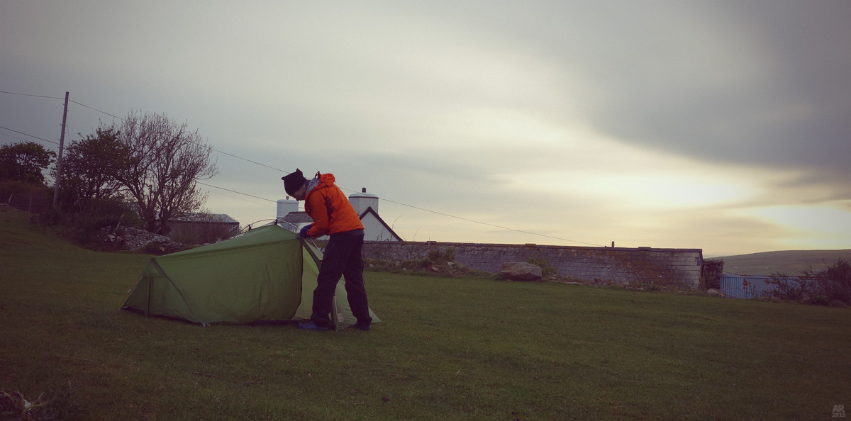
DAY 10, FISHGUARD+ to ALLT-Y-COED
 

Distance: 36,5 km
Time on trail: 6:00 – 17:00
Allt-Y-Coed Farm 5£


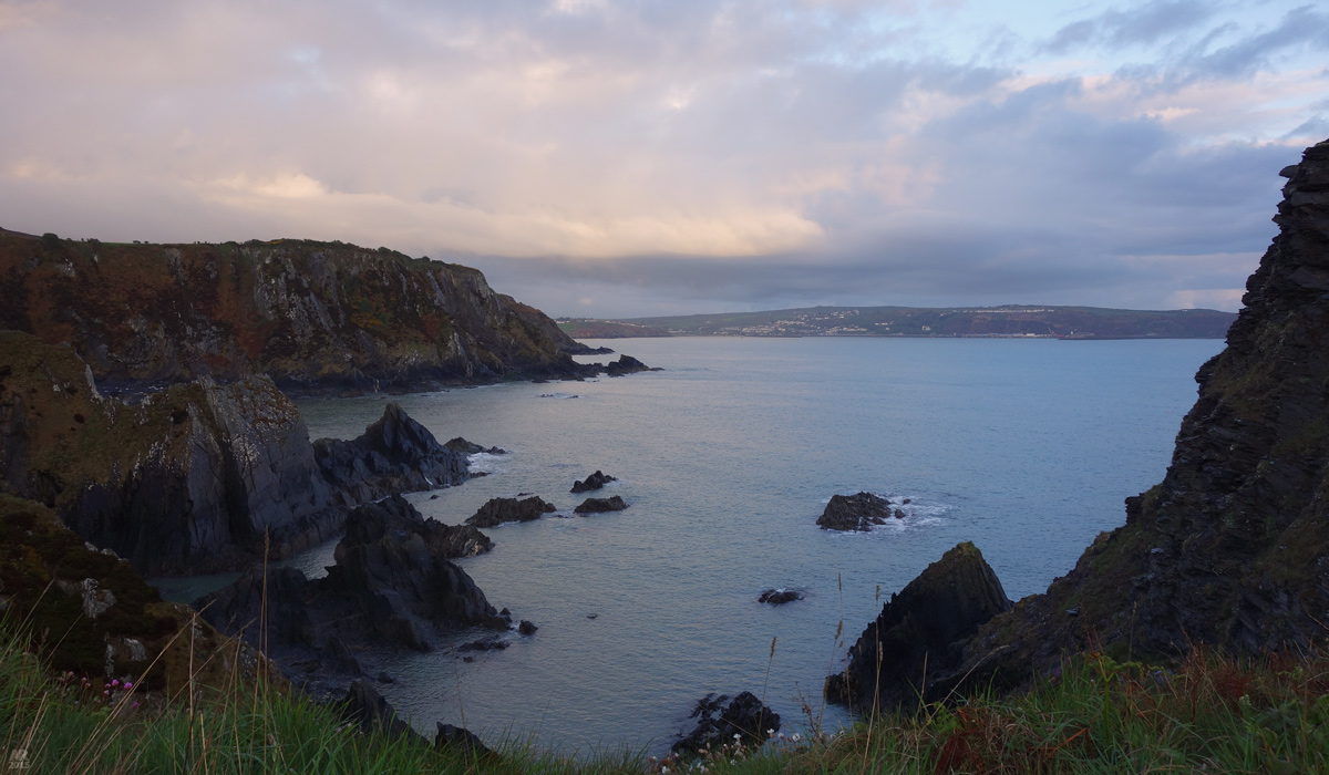
A beautiful morning was inspiring and with full of energy, I headed onwards.


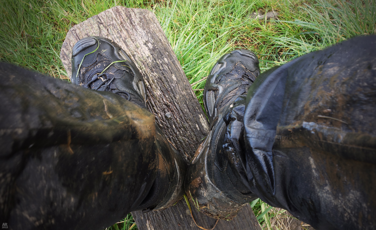
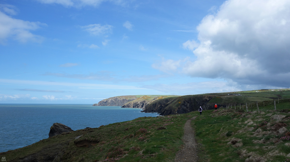
I had dried my shoes and socks well during the night – but for nothing! The trail was so narrow that all the moist grass around made my feet wet again in no time. And the whole tour around Dinas Island was absolutely full of sheep and cow waste. But I saw porpoises. Near Needle Rock, which was full of sea birds, two porpoises swam along the bay, their dark backs glimmering in the morning sun.


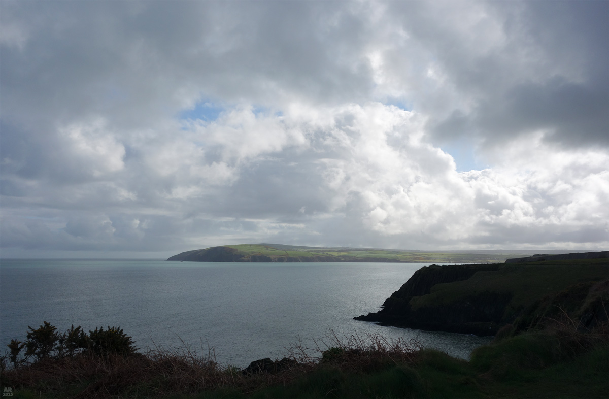
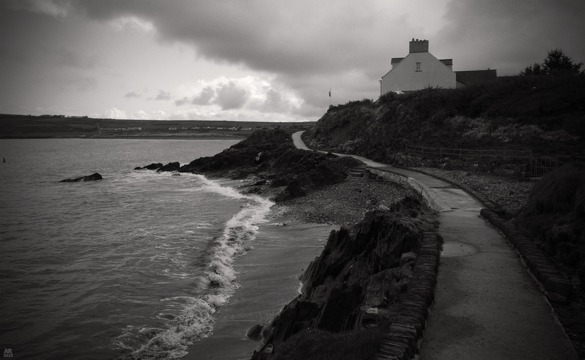
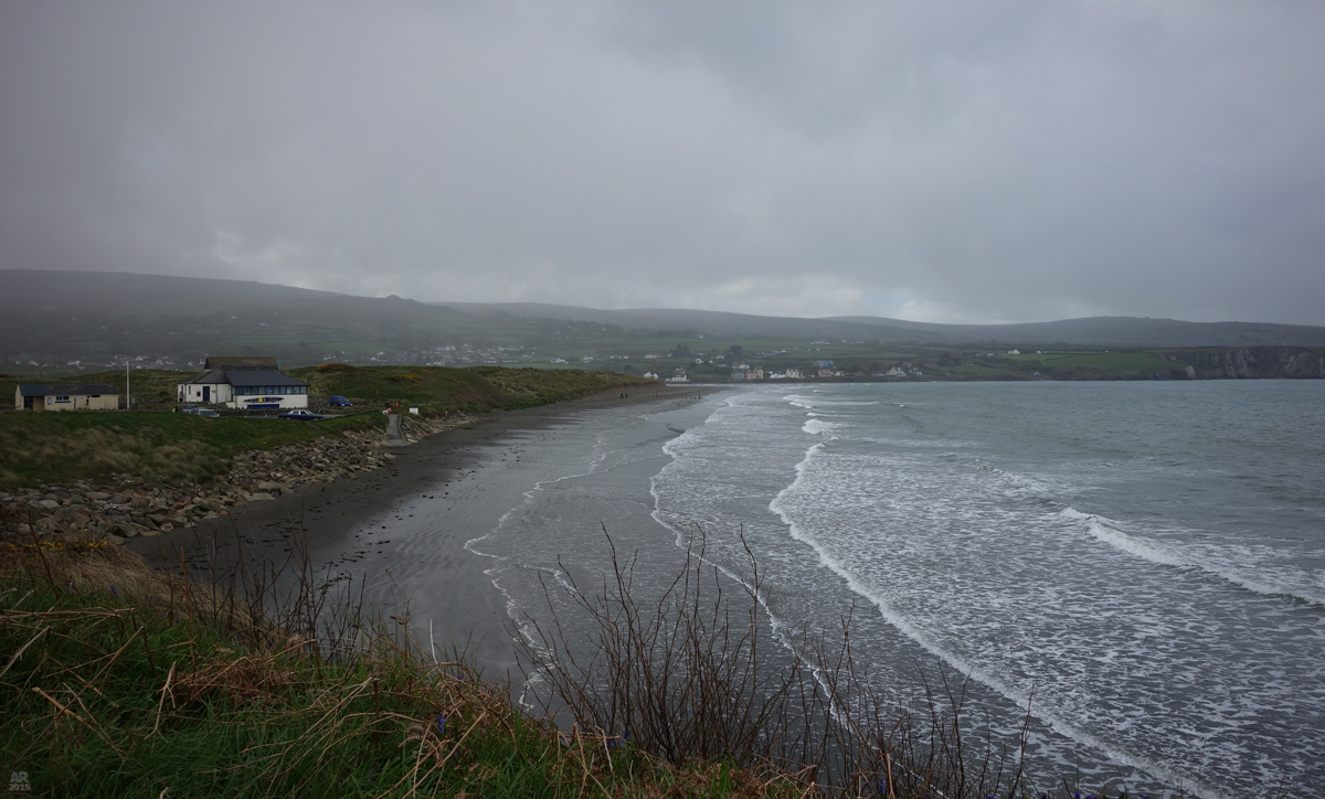
Despite the nice sight, my mood went worse as it began to really hurt my feet. My body was sensing how the end was drawing near and it wanted to give up already. I expected to have a long break at Newport before starting the last official section, but it was cold and rainy again. I ate quickly and kept going, grim look on my face.


There are more than 500 gates along the Coast Path, and now only 36 was left. The end was close!


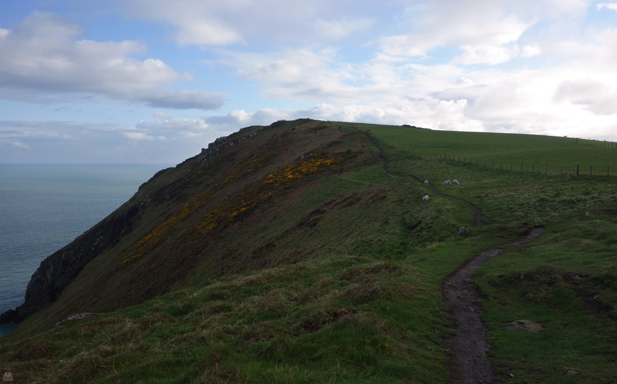
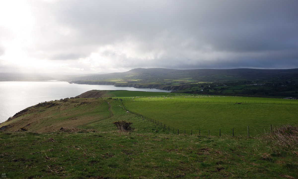
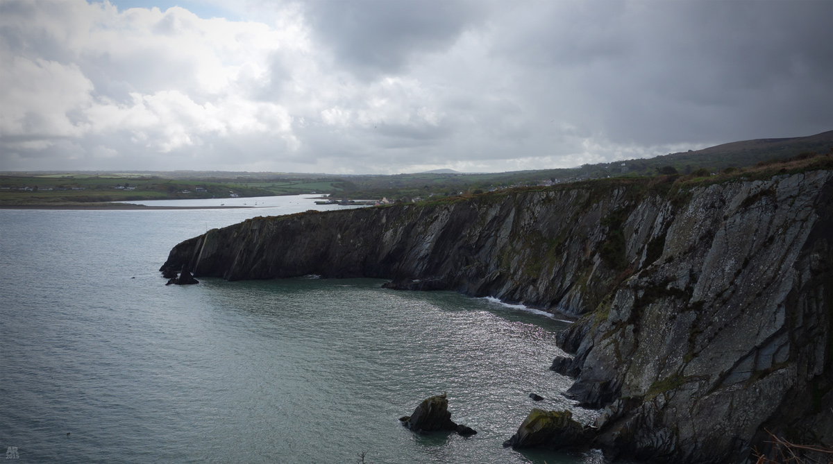
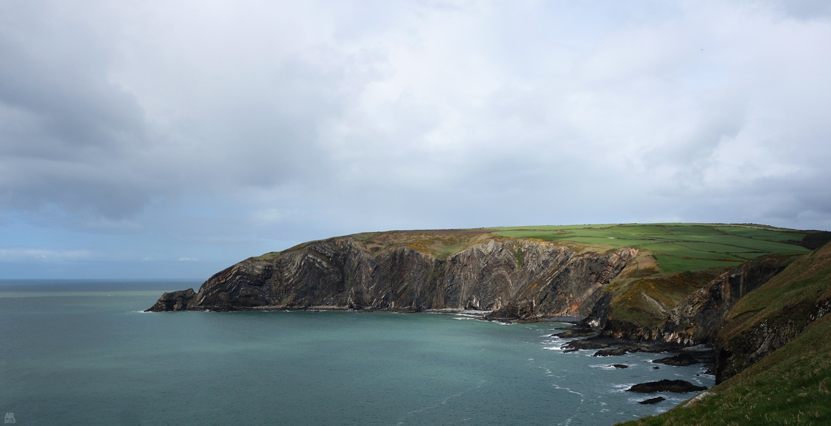
But the last 20km were supposed to be the toughest on the whole trail. It was the most beautiful section too and fortunately I left the rain behind. At Witch’s Cauldron I kept a longer break, and even if at first it felt like doing more harm for my tired legs and hurting feet, they warmed up one last time.


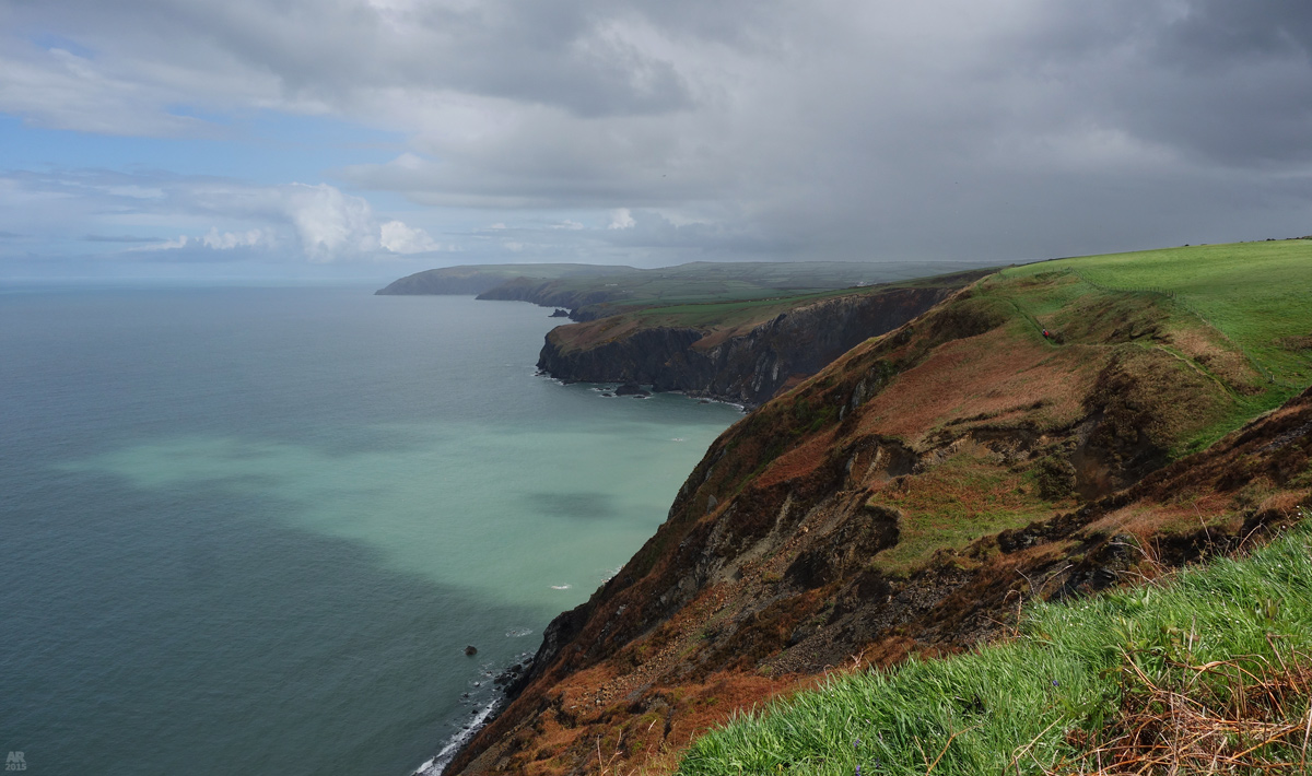
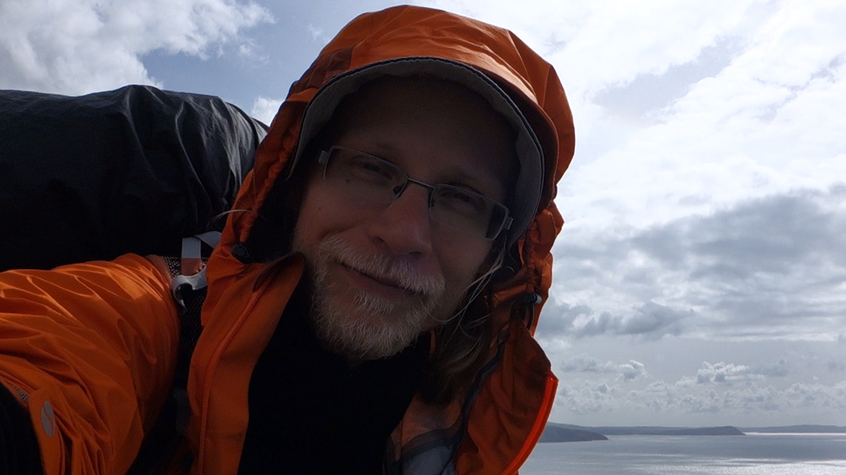
The last few hours went in a flow, not really feeling any pain but the sweet taste of a victory. I climbed the flanks of Foel Hendre like in my best days in the Alps. It was easy to smile at Cemaes Head, near the Allt-y-Coed campsite.


DAY 11, ALLT-Y-COED to CARDIGAN
 

Distance: 8,5 km
Time on trail: 8:00 – 9:40


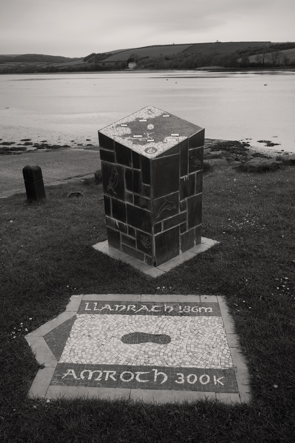
On the last day I walked to the official end of the trail and then to Cardigan. As soon as I boarded a bus to Carmarthen it began to rain, and in Carmarthen it was pouring with water. I waited long hours before my train towards London Gatwick arrived.

SUMMARY
I had high hopes for this hike and in some way I felt a bit disappointed in the end. The weather wasn’t the best, of course not the worst either, but compared to the sunny and warm spell just before my trip, I couldn’t help but to feel slightly unfortunate. The constant wind really got on my nerves and made the evenings very chilly. The other minus factor was the total absence of fellow long-distance hikers and the feeling of belonging to the community of hikers. It was perhaps too early of the season or bad timings, but I was the only hiker camping in all of the campsites! The trail felt also few days too long. I think it would work best as a hike that could be done in a week.
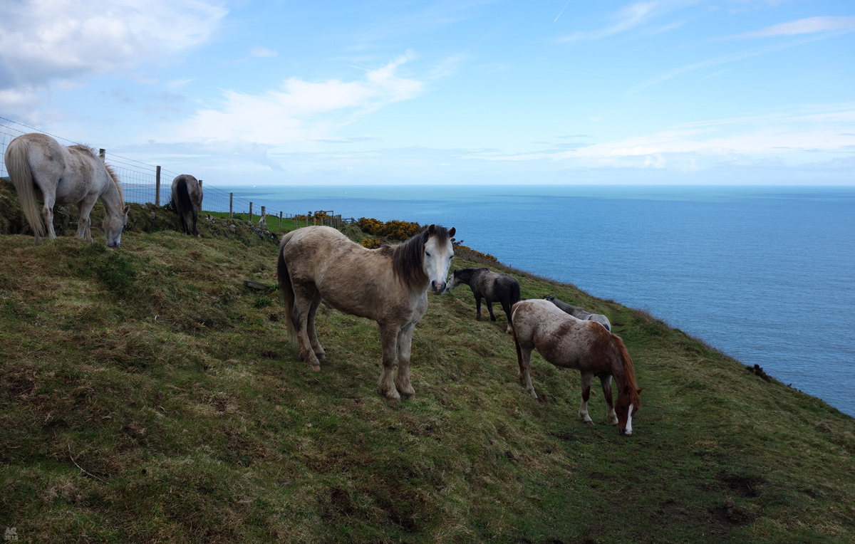
But nevertheless it’s a beautiful trail with plenty to see. And if you’re interested in birds and wildlife, you’ll get even more out of it. Just remember to bring small binoculars!

kukko

  • Jr. Member
  • **
  • Posts: 80
Re: [TR] Pembrokeshire Coast Path 2015
« Reply #11 on: 12:54:18, 06/11/15 »
Great stuff Kukko  O0  Wonderful photos, except the photo of your feet  :o , You are keep adding stuff as I try to reply, so I may have more to look at yet  :)

Thanks April!

I didn't have any real blisters though, or big troubles with my feet, they just got very wrinkled after being so long wet :)

bricam2096

  • Veteran Member
  • *****
  • Posts: 3577
Re: [TR] Pembrokeshire Coast Path 2015
« Reply #12 on: 13:04:44, 06/11/15 »
Enjoyed reading the report and looking at the photos, I do enjoy coastal walking and I imagine this walk would be even better in the summer but with the British weather, who knows?  O0
LDWs done - 32 in total including 16 National Trails and 3 C2C

Wainwrights 176
www.brians-walks.co.uk

Phileas

  • Full Member
  • ***
  • Posts: 173
Re: [TR] Pembrokeshire Coast Path 2015
« Reply #13 on: 15:07:54, 06/11/15 »
It so happens I completed this trail earlier this week (although I only walked from Goodwick to Pendine, having done the first bit as part of a previous trip).


It looks like you were quite unlucky weather wise. In my experience of multi day treks in GB including the South West Coast Path, most of the time, even during unsettled spells, the weather is ok. Camping in bad weather I would imagine can be rather demoralising to say the least, not to mention the rather large daily distances you undertook. (I'm a 15-20 mile B&B type.)


I also didn't encounter many other hikers but it is very much end of season. I've found Wales to be generally less populated with walkers than other areas although I tend to walk slightly outside of the main season and I've never encountered significant numbers of other hikers except on the Coast to Coast which is at the other extreme.
Robin

sunnydale

  • Veteran Member
  • *****
  • Posts: 9105
Re: [TR] Pembrokeshire Coast Path 2015
« Reply #14 on: 15:23:41, 06/11/15 »
Brilliant report & photos Kukko.  Brings back lots of lovely memories for me O0   
***Happiness is only a smile away***


Terms of Use     Privacy Policy