Sunday was a much nicer day with blue skies and sunshine. We were too late getting up to go the Lakes so we got a bus east and got off at Low Row. Still in Cumbria but close to the Northumberland border. On a train journey to Newcastle I'd spotted a church near Low Row and the countryside was very pretty near by. I thought a visit was worthwhile. I had meant to do some research on the route but hadn't had time so it was a bit of a magical mystery tour. We had planned to go down to Denton Hall from the A69 and had backtracked from the bus stop along the main road for ten minutes only to find the gate padlocked where the track started. Unless we were in the wrong place this gate should have given access to a route that was "other route with public access" indicated by green circles on the map

We retraced our steps along the main road to another footpath that lead to Low Row. I wish I'd researched the walk first.
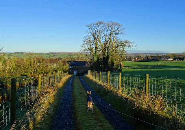
On the way down the footpath to Low Row
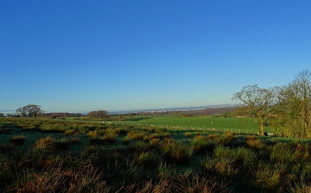
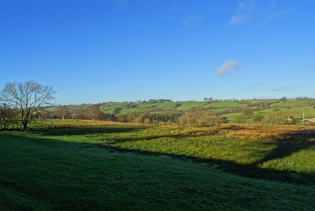
The view to the west from near Low Row
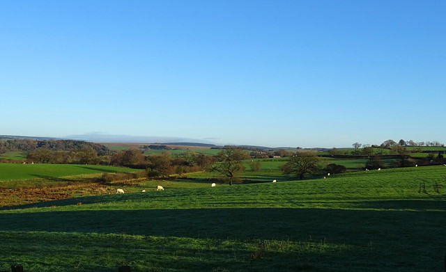
Looking east from near Low Row
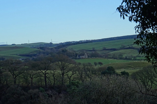
The church I'd spotted on the train can be seen in this shot. We got to a gate that was tied with a knot that was very difficult to get open. At first we thought we'd taken a wrong turn. Surely this couldn't be the gate on the right of way! It was! Once through it there was another gate to open with the same difficult knot to untie. We were talking to a man later at the bus stop and he asked us if we were the people he'd seen on the footpath having trouble with the gate. We said we were. He said we were the first people he'd seen on the path in four years

Leaving Low Row
We were walking toward Low Birkhurst but not the way we had planned to originally due to the padlocked gate.
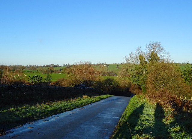
Pretty views on the walk to Nether Denton church
At Low Birkhurst there was a little confusion. A sign on a gate saying "permissive path" that wasn't marked on the OS map and we had walked by it. We heard someone shout "through the gate!" at us from the house
Further confusion at Low Broom Hill followed. I'm not sure if I was having a bad day navigating or if the map, paths, signs and finger posts weren't very clear. Possibly a bit of both

More lovely views near St Cuthbert church at Nether Denton

We walked by Wallholme Bridge to Nook. We would be crossing it from the other side later on, when we returned to Low Row for our bus.
St Cuthbert, Nether Denton

This is the church I'd seen from the train. It was in a very pretty setting. Again I had trouble working out how to access the church. We'd walked up a lane but it seemed to lead into someone's garden. We retreated to find a hidden sign that had fallen down and was covered in leaves that said "Church Hill, PRIVATE" Oops. We found the path into the churchyard after that, indicated by a sign saying "public footpath"
The church was built at the site of a roman fort.
Lanerton Bridge
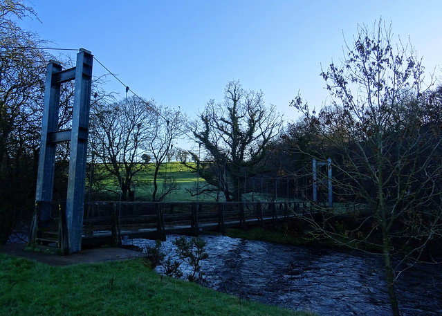
If you like feeling seasick you will enjoy walking across this bridge. It moves rather alarmingly as you walk across it and with the river quite full below that was whizzing by underneath to add to the effect. I was ready to throw up by the time I got across it.
Beefy and Squeaky on the footpath next to the River Irthing
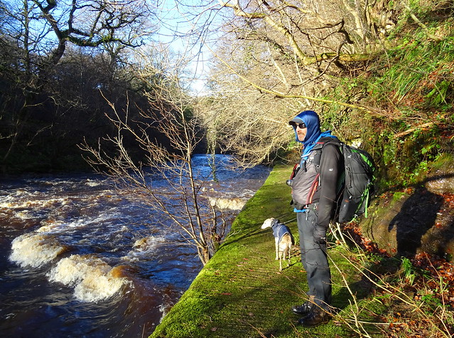
We walked along the path that got quite high above the river in places with some steep drops to the left. My head was still wibbly wobbly along with my legs after the swaying bridge so it was slow progress.
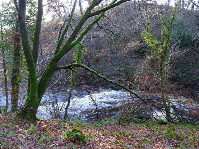
The River Irthing
We stopped for some lunch sitting in the sun next to the river.
I think this is Wall Burn tumbling into the River Irthing
We took the path away from the river up to the Hadrian's Wall path before leaving it to descend to Wallholme.
St Cuthbert church from the path to Wallholme
There was more confusion here near to Wallholme. The path marked on the map, was not where it was on the ground
We had to double back through lots of mud to get on the path again. I rechecked the map several times and we should have been on the other side of the fence if the map was right. Some waymarkers might be helpful here because the path is actually on the other side of the fence and closer to the river than it is shown on the map. I wonder if it has been diverted since the map was published? Over the bridge at Wallholme we retraced our steps to Low Birkhurst. We tried to use the public access path to Denton Hall but we were stopped by the ford. No footbridge and Carling Gill was too deep to cross. Denton Hall mustn't want any walkers going by it. At one end a padlocked gate prevents access and a ford at the other does the same! We walked back along the lane to Low Row and we took a footpath near Denton House and back again to fill the time before the bus came. Our route was Low Row - Low Birkhurst - Low Broom HIll - Nook - Baggarah - Lanehead - Nether Denton Church - Lanerton Bridge - Hadrians Wall path - Wallholme - Low Broom Hill - Low Birkhurst - Ford - Low Row. 15.3km with 300m of ascent. It was a nice walk in parts but I didn't really enjoy the navigation bit, better signage would be helpful in places, especially when the paths were shown differently on the OS map. I suppose the locals must be used to folk wandering about in the wrong place trying to find the paths


