Day walks again for us because the wind was forecast strong and increasing overnight, gale force at height. Not wild camping weather

We drove to Mungrisdale and parked in the village hall car park, paid our £2 and set off up the valley next to the River Glenderamackin. We were doing a new AW for Squeaky, Souther Fell.
Walking from Mungrisdale

The riverside path is washed away in places

One part of the path has been diverted over big stone slabs where there is little left of the riverbank path. There is still a short part of the route where you have to walk along stones in the river and care has to be taken on the bit in the photo above.
On easier ground

The path was very wet and boggy, wetter and boggier than I can remember here. We thought we might put this route on the banned list but thought that was too harsh. We opted instead to put it on the Only to be used if there is no alternate route list.
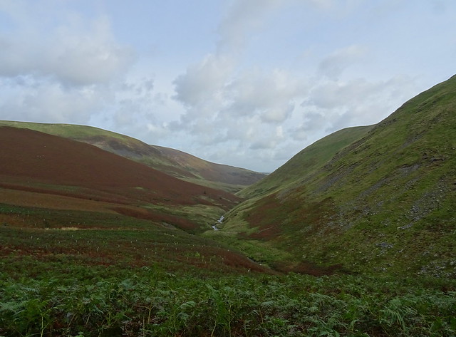
Bannerdale Beck

We reached Bannerdale Beck at the ford. There was a lot of water coming down the beck so we walked upstream to see if there was an easier place to cross. We crossed the beck just above centre of this shot above.
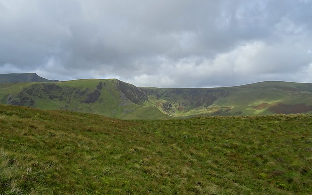
Zooming on Bannerdale Crags

Our way ahead to Mousthwaite col

Looking back at our route along side the river
Dropping down to the new fb over the Glenderamackin

We stopped for some lunch beside the bridge. It was mostly out of the blustery wind that had been in our faces most of the way.
Pleb pigging out on Squeaky's left over dog food

Lunch over we crossed the fb and made our way up to Mousthwaite Col.
A look back to the fb and Sharp Edge in view

Going up to Mousthwaite Col

Sharp Edge from the way up Souther Fell

Squeaky leading the way up Souther Fell

Scales Fell, Blencathra and Bannerdale Crags

Looking toward Clough Head and High Rigg

There were a few spots of rain here but it didn't amount to much.
Bannerdale Crags from Souther Fell
We got a few brief spells of sunshine that lit up parts of the surrounding fells.
On Souther Fell summit

The wind was strong here so we didn't linger long
The view south toward Place Fell, Great Dodd, Clough Head and Catstycam in view

We descended in a northeasterly direction to pick up the path that leads to Low Beckside. A mistake because we came to a big patch of bracken and we had to descend steeply through it to reach the path. Hindsight is a wonderful thing, a southerly route to reach the path would have been longer but with less bracken.
On the way down to Mungrisdale

We were pleased to reach the path and we enjoyed the last bit of the walk with a bit of sunshine now and again.
Route map

Our walk was Mungrisdale - River Glenderamackin - fb - Mousthwaite Col - Souther Fell - Low Beckside - Mungrisdale. 4.85 miles and 356m ascent.


