We drove to the Galloway Hills for an overnighter on Sunday. We parked in between Loch Dee and Clatteringshaws Loch at Craigencallie House in a layby. The road to get there is a single track road from the A712 with very few passing places and we had a four by four with trailer coming toward us. I reversed, slowly. I hate reversing, I just can't do it and eventually the driver lost patience because I was taking ages so he pulled off onto the rough ground to let me pass him

The road is very rough in places too so I wouldn't recommend this as a starting point. We walked along the forest road toward Loch Dee. It was a bit breezy but we had nice views.
On the forest road

Craignaw and Dungeon Hill

Curleywee and Mulldonach are the hills in this shot with a peep of Loch Dee

Loch Dee

White Laggan bothy

We had our lunch next to the bothy, pleased when the sun came out because it was chilly in the breeze. We chatted to a nice young couple who'd spent the night in the bothy because their tent malfunctioned. It is quite clean inside for a bothy but stunk of smoke. We found the path marked on the map leading from the bothy up to Loup of Laggan.
Looking back at our route up from the bothy

The path was very wet and rough in places but not bad for Scotland!
The slopes of Curleywee to our right

I told you the path was wet

We were heading up to the col then turning left up the ridge. We thought the route may be pathless but we followed a quad bike track or a trod for most of the way.
Looking back at Curleywee

The view southward with the Isle of Man just visible

On the way up the ridge
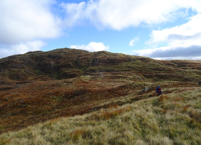
It was an interesting way up, all ups and downs and twists and turns. There were trods and quad bike tracks going off in a few directions but me managed to choose the right ones to keep us going where we wanted to go.
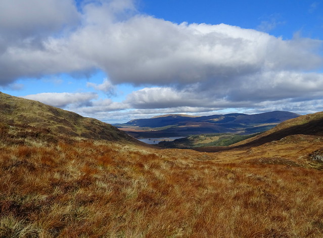
A peep of Loch Dee with the Rhinns of Kells behind
Black Loch

Lamachan Hill and Curleywee

It felt very wild and remote up here, what a wonderful place
White Lochan of Drigmorn

Millfore

We were going to pitch somewhere on this ridge, to the south of it so we could get a good sunset view.
Curleywee again but this time with Merrick, Craiglee and Craignaw in view
Fuffock is the name of the pool of water on Drigmorn Hill
This was taken from the ridge above Red Gairy.
Cairn on the south end of the Millfore ridge above Red Gairy

Larg Hill, Lamachan Hill and Curleywee from the same spot

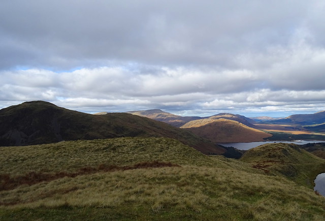
Curleywee, Benyellary, Merrick, Craiglee and Craignaw

It was almost 4 oclock and we started looking for a pitch. It was a bit breezy but we decided to pitch in the wind so we could look at the lovely views. We found a spot, got some water to filter from a nearby pool then got the tent up while it filtered.
The MSR above Red Gairy

Sunshine on Millfore

We would do the summit tomorrow but we knew it may be clagged in and possibly raining. We were surprised when 4 people turned up, fellow wild campers who pitched on the ridge about a 5 minutes walk away from where we were. They'd said hello as they passed our tent. Nice blokes and they joined us to watch the sunset as we had the best viewing point.
Zooming in on the Isle of Man

The sunset

Not that great to be honest, this was the best shot before the sun disappeared behind cloud
For Henry, a zoomed in shot of the view of the Mournes from our pitch

We had a restless night sleep because it started raining heavily and the wind buffeted the tent most of the night. We awoke to clag like we expected and neither of us relished the descent back to the car in the clag, rain and wind. I'd planned what I thought would be a quick way down, on the ridge from Millfore summit to Kirkloch then the forest road back to Craigencallie. We said good morning to one of the campers as we passed by on our way to Millfore summit.
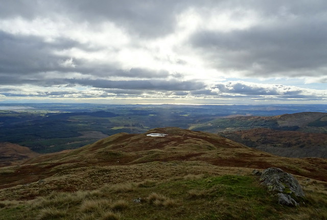
On Millfore summit

We didn't hang around. We were very wet already with the wind driving the rain at us. I had meant to take a compass bearing for the route we were taking from Millmore summit when we were still in the tent but I'd not. Long story short, I ended up leading us in the wrong direction twice, only spotted when I checked on Viewranger on my tablet. This made the route a bit longer and led us through more rough ground than we needed to. My tablet was in my pack safe from the rain and looking at it meant taking my pack off and it seemed to take ages each time. I have ordered a waterproof case for it for the next time I'm too lazy to navigate properly
We eventually reached the forest road 2 hours and 45 minutes after we set off from the tent. It should have taken an hour and twenty minutes. We stopped for a quick bite to eat sitting by the side of the forest road. We were soaked to the skin and just wanted to get back to the car as quickly as possible to get the wet things off so it was a very quick lunch stop.
On the forest road to Craigencallie

Day 1 was Craigencallie - White Laggan - Loup of Laggan - Black Loch - White Lochan of Drigmorn - pitch above Red Gairy
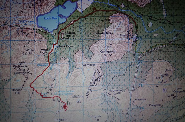
The walk started 0.2 miles before I remembered to start recording the route!
Day 2 was Pitch - Millfore summit - Kirkloch - forest road - Craigencallie

We had really enjoyed the first day but the second day was pretty grim with the weather.


