We parked at Loweswater in the layby near Askhill. We were out on a wild camp and we were bagging 3 more Wainwrights for Squeaky. It didn't look very promising as we walked toward Hudson Place and Holme Wood.
Gloomy skies above Loweswater

Holme Force

I spotted a path snaking up beside the waterfall and some total idiot (myself

) thought it would be a great idea to follow it up instead of continuing along the forest road on a longer route that would meet the path leading to the gate near Holme Beck. This path was awful, slippery with mud, very steep, had slimy rocks, wet tree trunks, all alongside a big drop to the right into the waterfall! We should have turned back but we carried on struggling up with our camping packs. When we stopped for a rest which was frequently, a million midges descended on us

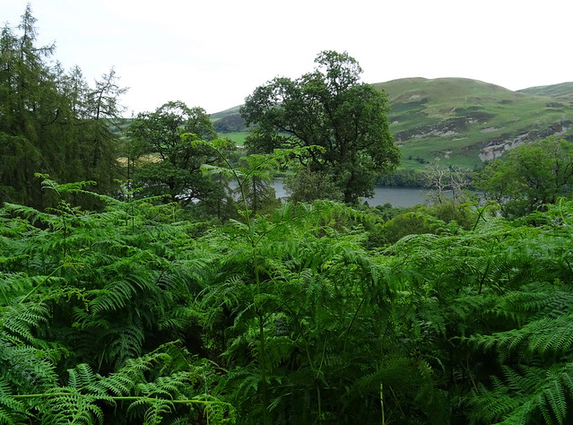
The path ended up going through wet, high bracken. Perfection! We were soaked by the time we got through it and my hair was wet, because the bracken was taller than me
You would think it had been raining if you'd seen us. We were grateful to see the gate and a decent path. We were knackered and we stopped for some lunch beside Holme Beck. I looked at my tablet and we had only done 1.6 miles in one hour thirty

Needless to say that path is on the Never Again List.
Very high bracken
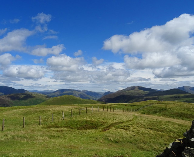
Criffel seen above the Terrace Path

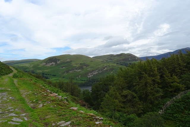
I hand filtered some water with the Sawyer Micro Squeeze using the Sawyer bag. It took about 58 seconds for 800ml of water. After lunch we were going along the Terrace path to climb Burnbank Fell
Darling Fell and Low Fell from the Terrace Path
The earlier gloom had lifted as we climbed the horrendous path and fought through the bracken so we had some nice views.
View back to Holme Beck where we had lunch

View of Whiteside and Grasmoor from the Terrace Path

On the Terrace Path

We said hi to 2 lads who were coming in the opposite direction. I thought I recognised one of them but I couldn't place where I'd seen him before

He did look familiar!
The old quarry workings on Burnbank Fell

View from the climb up Burnbank Fell

On Burnbank Fell
Peeky Squeaky!
Blake Fell from Burnbank Fell
It looked a long way off. We had both struggled with the ascent, hay fever hell, with pollen affecting being able to breathe properly, which is useful when going uphill.
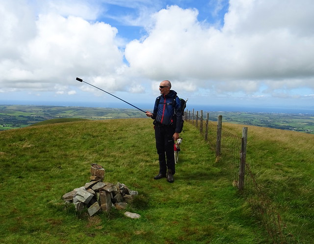
On Blake Fell summit

Skiddaw, Whiteside, Hopegill Head, Grasmoor, Whiteless Pike and Mellbreak in view from Blake

In the far distance right, Catstycam and Helvellyn can be seen
Whiteside, Hopegill Head, Grasmoor, Whiteless Pike, Mellbreak, Robinson, Fleetwith Pike, Hen Comb, Red Pike and High Stile

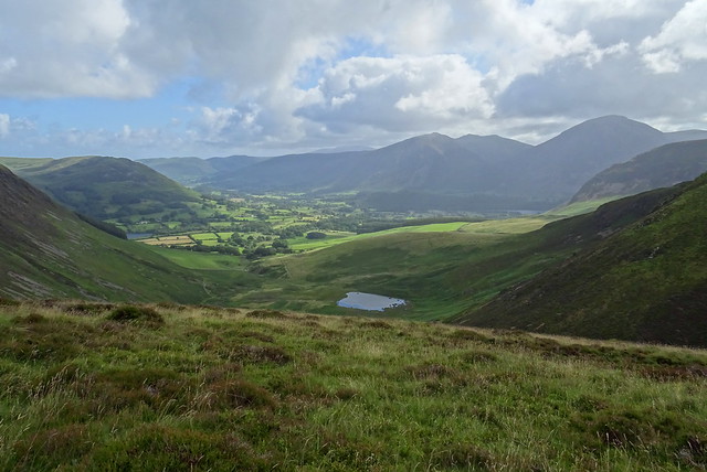
Next up was Gavel Fell. We stopped for a rest on the way. We had plenty of time to spare; we were wanting to pitch on Gavel Fell but it was too early and there were quite a few people about. Never seen as many people on these fells before!
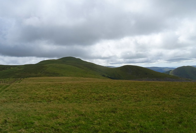
View from Gavel Fell summit
Wainwright number 3 of the day for Squeaky.
View from Gavel Fell summit

It was still too early to pitch so we had a walk over to this unnamed top about half a km to the north east of Gavel Fell.

We looked around to see if there was anywhere to pitch there but we thought the sun would set behind Blake Fell and we would miss it.
We walked back over to Gavel Fell. There were still people about, it was only 4.30 so we got our chairs out, delaying pitching the tent. Beefy had a great idea for a windbreak using the footprint against the fence. So we sat very comfortably for almost 2 hours and we had our tea after filtering some water from a pool of water near the summit. It was discoloured but tasted fine when it was filtered. We put the tent up about 6.30, nobody about now. The ground was lovely and soft, mossy but dry.
The MSR on Gavel Fell

The view from our pitch

We got our gear set up inside and had a glass of wine. Thoughts turned to the sunset but it had clouded over out to the west. We kept popping out of the tent to have a look during sunset time (not in view from the tent pitch) but there wasn't much of one with all the cloud. We finished our wine and fell asleep as soon as our heads touched our pillows!
Day 1 was Loweswater Layby - Hudson Place - Holme Force - Holme Beck - Terrace Path - Burnbank Fell - Blake Fell - Gavel Fell - Unnamed top - Gavel Fell. 5.4 miles with 695m of ascent says viewranger. It had felt much longer than that!
Day 1 map and route

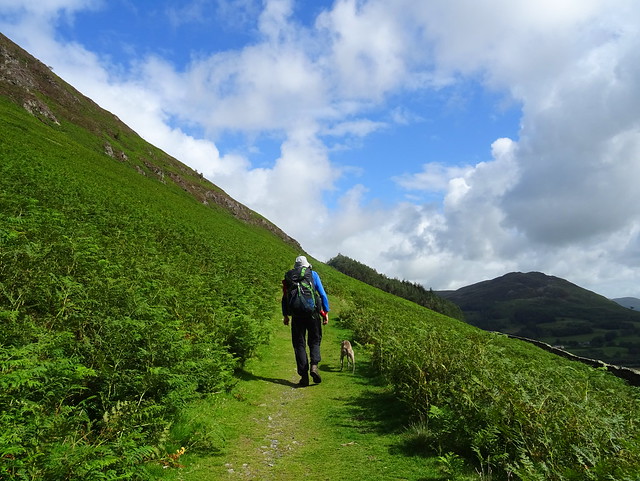
We were packed away by 9am and we said hello to a couple who must have had an early start because they were on Gavel Fell summit a few minutes before we left. They asked if we'd had a good night out and we said we had, nice couple they were. We walked to the col between Gavel Fell and Blake Fell and took the narrow path leading to High Nook Tarn.
On the way down to High Nook Tarn

High Nook Tarn
This is the first time I've seen this myself, only ever seen photos of it previously.
Waterfall seen on the way down

The path down seemed to go on forever!
Another waterfall

The steep climb up to the Terrace Path above Holme Wood
We'd gone past High Nook Tarn and over the footbridge. It had been a hurried plan this weekend and I wasn't expecting this long climb up after the long descent. Serves me right I should have spent more time looking at maps

Hen Comb left and Gavel Fell in view looking back at the climb up

There was more climbing before we reached Holme Beck but it was too windy to have lunch there so we dropped down to Holme Force to have a break. This time we used the path through the wood to the forest road and turned left to the waterfall.
The path next to Holme Force (not to be taken, ever)

We got our chairs out to the right of the waterfall, well enough away so people could still get a photo of the falls. We had a brew and some food. The couple we'd seen on Gavel Fell summit passed by and we said hello again

Shelter in Holme Wood

We'd seen this yesterday, today we came and had a closer look. It has a few rather uncomfortable looking chairs inside. Not sure if this is an illegal shelter or if it has been built with permission.
Day 2 was Gavel Fell - High Nook Tarn - Holme wood - Holme Force - Hudson Farm - Loweswater Layby. 4.23 miles with 173m ascent says viewranger. It certainly felt longer than that again!
Day 2 map and route


